
We build the scanners that go where the survey crew should not
Artec 3D develops and manufactures professional 3D scanning hardware and software used across mining, heavy industry, engineering and research. This site covers the mining side of that work.
Measurement that does not depend on access
Mining has always had the same measurement problem: the geometry that matters most sits where it is least safe or least practical to stand. A freshly blasted heading, the inside of a SAG mill, a pit wall that has started to move, a shaft that has not been entered in decades. The traditional answer was to accept fewer measurements, taken later, by someone who had to go there.
Our position is that this is a hardware problem with a hardware answer. If a device can hold its own positional reference without GPS, survive IP65 conditions, run without an on-site PC or external power, and be flown, lowered, driven or carried, then the access constraint stops setting the limit on how well a site is understood.
Three devices, one dataset
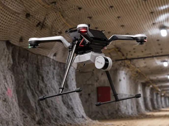
Artec Jet is a multi-modal SLAM LiDAR system for ground coverage and voids. Artec Ray II is a tripod-mounted long-range laser scanner for metrological accuracy at distance. Artec Leo is a wireless handheld scanner with its computer, screen and battery onboard, for detail you can reach. Artec Studio and Artec Twins merge their output into one georeferenced model, and export it into the mine planning software your team already runs.
Artec 3D
- Founded2007
- HeadquartersLuxembourg
- Mining scannersArtec Jet, Artec Ray II, Artec Leo
- SoftwareArtec Studio, Artec Twins
- Export formatsLAS, LAZ, E57 point clouds and standard meshes
- Planning softwareMaptek Vulcan, Deswik, Micromine, GEOVIA Surpac, Leapfrog
- SupportCertified partner network, demos on your own site
How we work with mining operations
Scanners reach mines through a network of certified Artec partners who know the local operating conditions and the software the site already runs. That matters more in mining than in most industries: a demo on a showroom sample proves nothing about a stope, a mill liner or a pit wall in your rock.
So the walkthrough happens on your asset, and the accuracy figures get argued against geometry your engineers already know the dimensions of. If the comparison against your existing survey control does not hold up, that is a useful outcome too.
Mining
Tell us about the asset you cannot get a crew to
A specialist will tell you which of the three scanners fits it, what accuracy to expect at that stand-off, and how the point cloud reaches your planning package.