Survey the whole mine without sending anyone into it

Whether you are surveying a stope, monitoring ground movement or reprofiling a processing plant, Artec 3D scanners capture the data your engineers need — at speed, GPS-free, and without putting crews in front of unstable ground.

Artec Jet, Ray II and Leo all run without GPS, an on-site PC or reference markers.

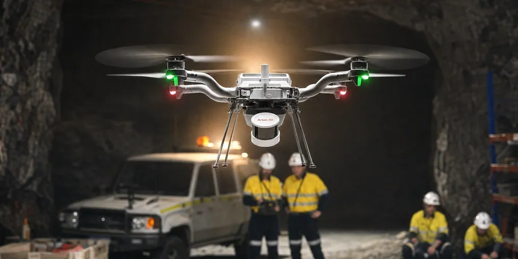
Artec Jet mounted on a drone flying an underground mine drive while the crew watches from a safe distance
What that means underground
  • GPS-free operationSLAM positioning holds its own reference underground, inside plants and at the bottom of deep pits.
  • 5 mm change monitoringRepeat scans resolve movement small enough to act on before it becomes a ground-control problem.
  • 360° shadow-free coverageFull spherical capture leaves no blind side behind a pillar, a service line or a muck pile.
  • Zero crew exposureFly, lower or stand off from unstable headings, active blast zones and open voids instead of entering them.

What do you need to capture?

The three scanners cover different geometry at different stand-off distances. Pick the task you are trying to close out and start from the device built for it.

Recommended for this1 match
Artec Jet SLAM LiDAR scannerPrimary for shaft inspectionArtec JetSLAM LiDAR, ±10 mm underground, drone or pole mounted
Recommended for this2 matches
Artec Ray II long-range laser scannerMetrological stand-offArtec Ray IILong range to 130 m, 1.9 mm at 10 m
Artec Jet SLAM LiDAR scannerArtec JetWalk or drive the bench, 300 m range
Recommended for this2 matches
Artec Jet SLAM LiDAR scannerFastest over groundArtec JetWalk or drive the pile, 1.9 M points per second
Artec Ray II long-range laser scannerArtec Ray IITripod capture where the tonnage has to defend itself
Recommended for this2 matches
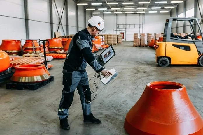
Artec Leo wireless handheld 3D scannerDetail inside confined spaceArtec LeoHandheld, wireless, 0.1 mm, no PC on the gantry
Artec Ray II long-range laser scannerArtec Ray IIThe whole mill shell in one set-up
Recommended for this2 matches
Artec Jet SLAM LiDAR scannerPrimary for convergenceArtec Jet±5 mm change detection, ±0.03% drift
Artec Ray II long-range laser scannerArtec Ray IIFixed stations for the tightest deformation series

Why the current survey method keeps costing you

Someone has to stand in the worst place on site

Tape, disto and total-station work puts a surveyor at the face, under freshly exposed backs, or inside a mill. Every measurement is a person-hour of exposure, and the readings that matter most are the ones taken where nobody wants to linger.

Point measurements do not reconcile

A handful of spot dimensions cannot settle a tonnage dispute, prove overbreak or defend a wear allowance. You get a figure that should be right rather than a surface you can measure again later.

Photos record the scene but cannot be measured

Site photography after a fall of ground or a bad blast tells you what happened, not how deep the damage runs. Perspective distorts the spatial relationships you need for rill angles and re-entry planning.

The survey window closes before the detail is captured

Access is granted for an hour between shifts or during a shutdown. Coarse data is what fits in that window, so the fine geometry — liner profiles, bolt plates, pipe flanges — gets approximated and corrected later at the fabrication stage.

Send the scanner where you would not send a crew

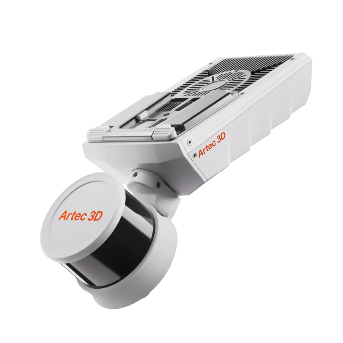
The Artec Jet is a multi-modal SLAM LiDAR: the same 1.57 kg head goes handheld, on a backpack, on a pole, on a vehicle, in a cage or under a drone. Underground, that is the difference between an entry permit and a flight plan.

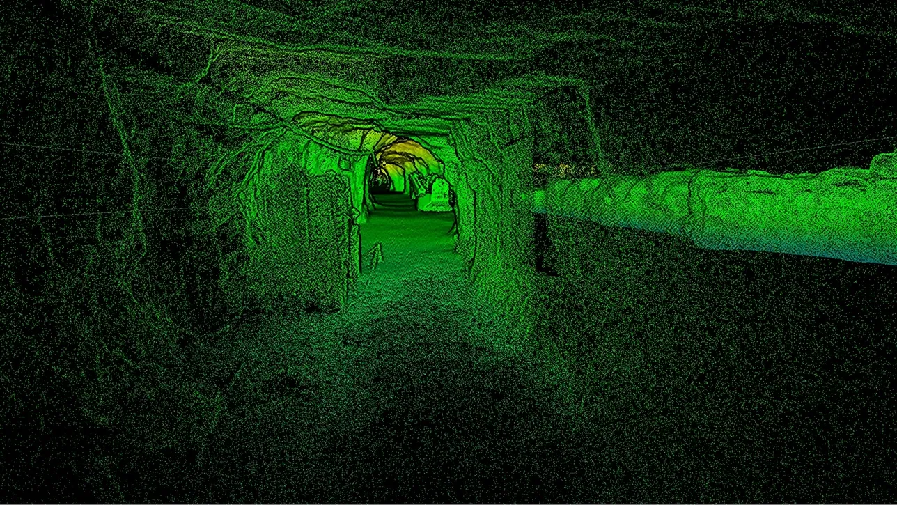
Point cloud of an underground iron mine drive captured with Artec 3D LiDAR
  • Autonomous flight into open voids: The drone-mounted Jet plans its own path and avoids obstacles as fine as 2 mm wires, capturing shafts and stopes with no one in the void.

  • Stand off from what is moving: Ray II reaches 130 m from a tripod, so pit walls, stockpiles and unstable headings are captured from ground you trust.

  • Zero light, dark rock, reflective ore: Jet scans in complete darkness on LiDAR alone, and Leo's HD Mode holds onto the dark and specular surfaces that defeat many optical scanners.

  • Nothing to set up first: No GPS lock, no on-site PC, no external power, no reference markers — walk into a narrow drift or equipment bay and start scanning.

From mine to deliverable in three steps

Capture the as-built reality underground or on surface, process it into high-accuracy 3D, and hand your engineers the volumetrics, deviation reports and digital twin they already know how to use.

  1. 1. ScanOpen pits, underground headings, processing plants or stockpiles, using whichever device matches the environment — Jet for mobile coverage, Ray II for metrological stand-off, Leo for close-range detail.
  2. 2. Process and mergeArtec Studio registers and aligns multi-scan data from Leo and Ray II into refined meshes with editing, sectioning and deviation analysis. Artec Twins handles the large Ray II and Jet datasets, merges Leo scans into them, and adds GNSS georeferencing for surface accuracy.
  3. 3. Export into your stackLAS, LAZ and E57 point clouds or standard meshes go straight into Maptek Vulcan, Deswik, Micromine, GEOVIA Surpac and Leapfrog — no new software for the planning team to learn.
Above-ground and below-ground captures merge into one georeferenced digital twin of the whole operation.

What changes once the site is a measurable surface

The value is not the scan. It is that the geometry stops being a trip back to site every time a question comes up.

Hours instead of days on site

Titan Engineered Solutions cut data capture lead times by two-thirds and captured a copper plant floor in one hour, against three to six hours of manual measurement.

Measure again without going back down

The captured surface is measurable months later. New questions about a heading, a flange or a liner profile get answered from the archive rather than from another entry.

One capture, every downstream team

Survey, geotech, planning, maintenance and the fabrication shop all work from the same point cloud instead of three incompatible measurement sets.

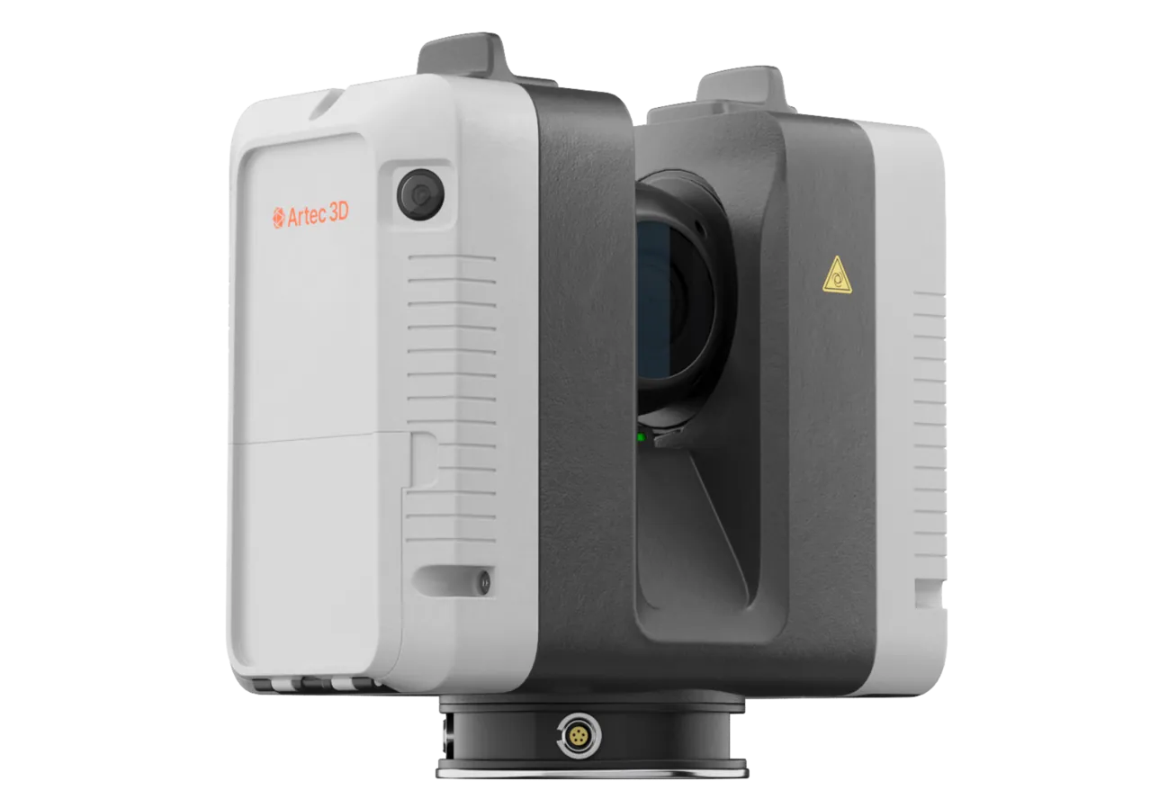
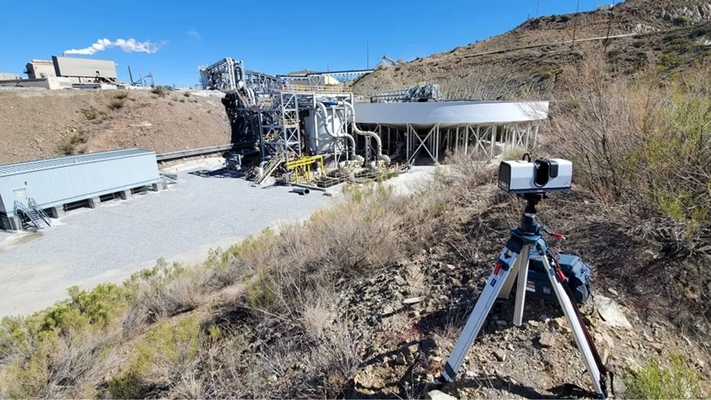
Artec Ray II on a tripod scanning a surface processing plant from a hillside above the site
Artec Ray II capturing a surface processing plant from the hillside above it

What to demand of any scanning system you put underground

Four questions worth asking of every vendor before a device goes down the decline.

A stated accuracy at a stated distance

"High accuracy" is not a number. Ask for the figure at the range you actually work at — Ray II is 1.9 mm at 10 m and 5.3 mm at 40 m; Jet holds ±10 mm underground with ±0.03% drift.

Export into the planning package you already run

If the data cannot land in Vulcan, Deswik, Micromine, Surpac or Leapfrog as LAS, LAZ or E57, it becomes a second workflow that nobody maintains.

One capture that serves more than one question

The same point cloud should give volumes, deviation against design, structural mapping and an as-built record. A single-purpose device gets scheduled out of the shutdown window.

Coverage you can verify on site

You get one access window. Real-time feedback on what has been covered — Leo shows the surface as it builds on its own screen — is what stops a second trip for the piece you missed.

Documented outcomes on real mining work

Four operations that replaced manual measurement on heavy mining assets, with the numbers they reported.

Challenge:
Engineers travelled to remote mine sites to measure by hand, then returned again when an unforeseen obstacle stopped an industrial floor, platform or pipe run from fitting.
Workflow:
Artec Leo and Artec Ray on site, then Artec Studio into Geomagic Design X for deviation analysis and SOLIDWORKS for the finished part.
Result:
Custom one-off pipes now meet end to end within 1.6 mm. A copper plant floor that took three to six hours to measure by hand is captured in one.
less time returning to site to correct design errors66%
Read the case study
Challenge:
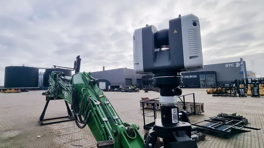
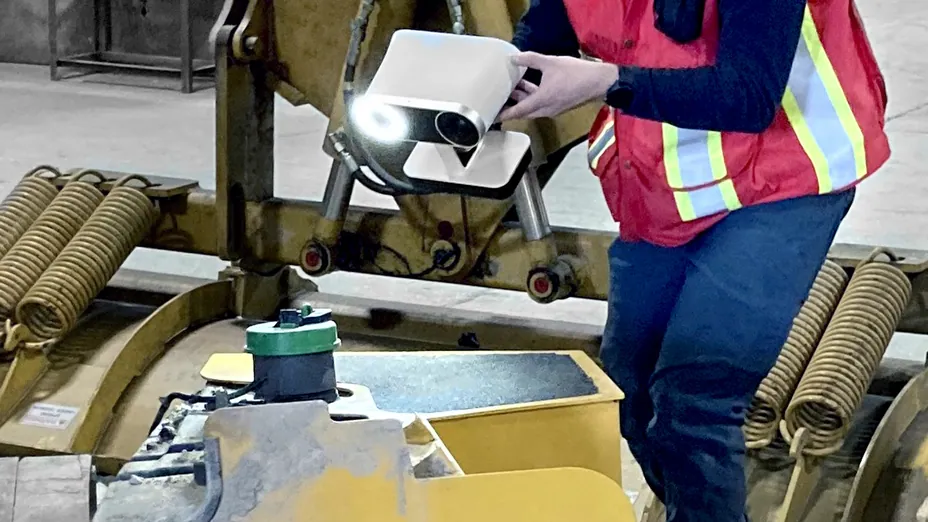
4C Creative CAD CAM Consultants had to fit a longer hydraulic arm to a 10 m excavator, which meant digitizing complex internals and an underbelly with roughly 80 cm of clearance.
Workflow:
Artec Ray II for the whole machine, Artec Leo for the tracks and confined internals, combined in Artec Studio with Smart Fusion and decimated for simulation.
Result:
A 50 GB capture reduced to a 300 MB model that still carried high resolution where the strength analysis needed it — and the underbelly was captured without lifting the machine.
of factory downtime instead of 2–3 days2 hours
Read the case study
Challenge:
Capturing heavy equipment geometry in outdoor conditions, confined spaces and elevated positions was slow by hand and put fitters in awkward places to do it.
Workflow:
Artec Leo handheld on site — screen and computer onboard, no laptop to carry — then Artec Studio, Artec Cloud and Geomagic for SOLIDWORKS.
Result:
A backhoe was captured in about an hour of scanning and eight hours of processing, work that had previously run to several days. Tasks that took half a day now take minutes.
point accuracy at 35 M points per second0.1 mm
Read the case study
Challenge:
Element manufactures spare parts for mining and construction, where a cone crusher mantle that does not seat correctly means shipping a very large component back.
Workflow:
Handheld structured-light capture of finished and worn parts, compared against the CAD in Artec Studio and Geomagic for SOLIDWORKS.
Result:
Scan-to-comparison inside four hours, and as little as 30 minutes on some jobs, holding tolerances under 0.1 mm per 1000 mm of diameter to ISO 9001.
from scan to deviation report4 hours
Read the case study

From the people running the scans

We can use the dimensions gained from a 3D scan to customize the piece and have it fit within a 16th of an inch (1.6 mm) accuracy. We do a lot of custom one-off pipes that meet end-to-end. Now we can ensure they fit without multiple tedious manual measurements.

Brandon KochGeneral Manager, Titan Engineered Solutions

Read the case study

Using Artec 3D scanning for quality control allows you to guarantee the customer a high quality of delivered products as well as minimize logistic costs that would've been incurred when returning large equipment.

Alexander Shestakov3D scanning expert

Read the case study

With hand measurement, you get rough 'that should fit' dimensions, compared to 3D scanning that tells you 'this will fit.'

Johnathan TurnerEngineer, Titan Engineered Solutions

Read the case study

Every time I visit clients, Artec Studio makes it so easy to demonstrate pinpoint alignment. You just find similar geometry between two scans and align it. When I show how simple it is, they're always blown away by what's possible with the technology.

Rogier RappardCo-owner, 4C Creative CAD CAM Consultants

Read the case study

Three scanners, three stand-off distances

Jet covers ground and voids, Ray II brings metrological accuracy at range, Leo resolves the detail you can reach by hand. Most operations run two of the three.

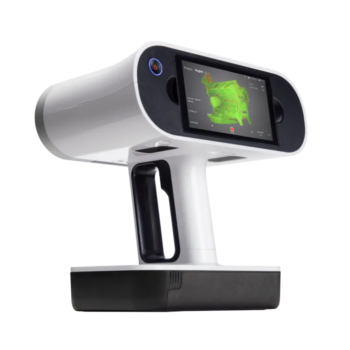
Artec Jet SLAM LiDAR scanner

Artec Jet

Type
Multi-modal SLAM LiDAR
Accuracy, up to
±10 mm underground, ±15 mm general
Change detection
±5 mm
Range
0.5–300 m
Capture speed
Up to 1,900,000 points/s, triple return
Field of view
360° × 290°
Positional drift
±0.03%
Ingress protection
IP65
Operating temperature
−10 °C to +45 °C
Weight
1.57 kg
Onboard storage
512 GB, about 16 hours
Deployment
Handheld, backpack, pole, drone, vehicle, cage, robot
Object size
XL, XXL
Best for
Shafts, stopes, old workings, convergence, production mapping
Artec Ray II long-range laser scanner

Artec Ray II

Type
Stationary long-range laser, tripod mounted
Accuracy, up to
1.9 mm at 10 m, 2.9 mm at 20 m, 5.3 mm at 40 m
Angular accuracy
18″, equal to 0.87 mm at 10 m
Range noise
0.4 mm at 10 m
Range
0.5–130 m
Capture speed
Up to 2,000,000 points/s
Field of view
360° × 300°
Resolution
3, 6 or 12 mm selectable at 10 m
Scan time
1 min 42 s at 3 mm, 10 m, without texture
Ingress protection
IP54
Operating temperature
−5 °C to +40 °C
Weight
5.35 kg
Battery
2 × Li-Ion, up to 4 hours each
Object size
L, XL
Best for
Pit walls, slopes, stockpiles, plant, whole machines
Artec Leo wireless handheld 3D scanner

Artec Leo

Type
Wireless handheld structured light, all-in-one
3D point accuracy, up to
0.1 mm
3D resolution, up to
0.2 mm
Capture speed
Up to 35,000,000 points/s in HD Mode
Reconstruction rate
Up to 80 FPS
Working distance
0.35–1.2 m
Volume capture zone
160,000 cm³
Texture
2.3 MP colour
Onboard
5.5″ touchscreen, NVIDIA Jetson TX2, 512 GB SSD
Power
Exchangeable battery, no external supply
Weight
2.6 kg
Object size
M, L
Best for
Mill liners, crusher chambers, wear parts, ground support hardware

Before it becomes a purchase order

Validation against your existing survey control

Run the scanner alongside your current total-station or drone photogrammetry workflow on a known heading before it replaces anything, and write the comparison into your survey procedure.

Training measured in days, not quarters

At Element, an engineer was scanning independently after two days of supervised practice. Artec partners run the walkthrough on site or online, in person where the mine is remote.

Your data stays where you put it

Capture is written to onboard storage — 512 GB on both Jet and Leo — and processed on your own machines. Nothing about the workflow requires a connection from the pit to the internet.

Try it on your own asset first

Artec partners will demo on your stope, your mill or your machine rather than a showroom sample, so the accuracy figures are argued on geometry your engineers already know.

The best reason to scan a mine is not the model. It is that nobody had to stand under the back to get it.

Questions that come up before the first scan

How does positioning work with no GPS underground?

Artec Jet uses SLAM — it builds its own reference from the geometry around it as it moves, holding ±0.03% positional drift, so it works the same in a decline, inside a plant or at the bottom of a deep pit. Ray II is tripod-based and does not need GPS at all. On surface, Artec Twins adds GNSS georeferencing where you want the capture tied to mine grid.

How does this compare to a total station for convergence work?

A total station gives you a handful of very accurate points. A scan gives you the whole surface at ±5 mm change detection, so instead of monitoring prisms you overlay two full point clouds and see where the heading is moving — including the places you did not think to instrument.

Will it survive the dust, water and temperature?

Jet is rated IP65 and runs from −10 °C to +45 °C. Ray II is IP54, rated −5 °C to +40 °C. Leo carries no external cabling or PC, which removes the usual failure point when a scanner is used in an equipment bay or on a gantry.

Does it work with no lighting at all?

Jet and Ray II are laser-based and scan in complete darkness — LiDAR provides its own signal. Leo is structured light and brings its own projector; its HD Mode is what handles dark rock and reflective ore or liner surfaces.

Can it really go into a shaft or an open void?

Yes. Jet is designed to be lowered or flown into vertical and near-vertical openings — shafts, ore passes, ventilation raises — and on a drone it plans its own flight path, avoiding obstacles as fine as 2 mm wires. That is the intended use, not an edge case.

Which software do we need, and does it reach our mine planning package?

Artec Studio registers and refines Leo and Ray II data; Artec Twins handles the large Ray II and Jet datasets, merges Leo scans into them and adds GNSS georeferencing. Both export LAS, LAZ and E57 point clouds and standard meshes for Maptek Vulcan, Deswik, Micromine, GEOVIA Surpac and Leapfrog.

How long does a survey crew take to become productive?

Days rather than months. Element's scanning engineer worked independently after two days of supervised practice, and Weldco-Beales reported that having the screen and computer built into Leo removed most of the learning curve because there is no separate laptop to manage.

Do we have to choose one scanner?

Most operations run two. The combination is deliberate: 4C Creative CAD CAM Consultants captured a whole 10 m excavator with Ray II and dropped Leo in for the tracks and confined internals, and both datasets merged in Artec Studio. Long-range plus handheld is how you get scale and fine detail in one deliverable.

Independent coverage

Trade press reporting on the equipment and the projects, for a view that is not ours.

press-article.svg

Artec 3D launches Artec Jet scanner for large-scale outdoor mapping

Fabbaloo on the Jet's launch, its SLAM approach and the deployment modes it was built around.

Read on Fabbaloo
press-article.svg

3D scanning for long-range excavation

Quality Digest, April 2026, on the 4C Creative CAD CAM Consultants excavator project using Leo and Ray II together.

Read on Quality Digest
press-article.svg

Why heavy equipment makers are turning to 3D scanning

Manufacturing.net on 3D scanning in excavator overhaul work and its effect on downtime.

Read on Manufacturing.net
Two mine engineers in high-visibility gear looking out over the benches of an open pit

Tell us what you need to survey

Describe the asset and the access window you get. A mining specialist will come back with the scanner that fits it, the accuracy you can expect at that distance, and how the data lands in the planning package you already run.