
Underground mine surveying
Underground, the survey is the thing that has to happen before anything else can: a stope cannot be reconciled, a heading cannot be checked against design and a back cannot be signed off until somebody has measured it. Every one of those measurements has been a person standing in the place least worth standing in.
Thirteen underground jobs below, from a single stope to a sealed-off level nobody has entered in years.
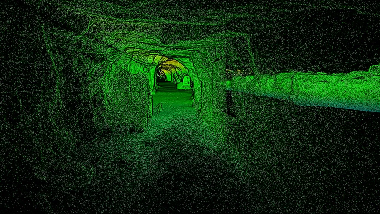
 No GPS, no targetsSLAM holds ±0.03% positional drift from the rock itself, so a decline is surveyed at walking pace.
 Into the voidLowered, flown or carried into stopes, shafts and ore passes without an entry permit.
 ±5 mm change detectionTwo scans a month apart turn convergence into a measured surface, not a handful of prisms.
 Straight into the planLAS, LAZ and E57 into Vulcan, Deswik, Micromine, Surpac or Leapfrog — nothing new to learn.
Openings and voids
The jobs where the constraint is access: what has to be measured is somewhere nobody should be.
Development and production
The jobs that run every cycle, where the cost is the time a heading stands idle waiting for survey.
Ground control and safety
The jobs where the measurement is about whether the ground is moving, and whether the support is where the drawing says.
Why the underground survey is the bottleneck
A conventional underground survey is a queue of set-ups. The instrument is carried to a station, levelled, oriented off known points, and then a few dozen shots are taken to the walls, back and floor. Move on, repeat. A heading that took the mining crew a shift to advance takes the survey crew a good part of the next one to pick up, and the mining crew waits for the result. The points that get shot are the ones the surveyor chose, and a question about anything else — a brow that looks undercut, a section that seems to have closed — means going back.
A SLAM LiDAR scanner records the whole surface while the operator walks the drive, with no set-up, no orientation and no GPS, holding ±0.03% positional drift from the geometry around it. What comes out is the complete heading, floor to back, at ±10 mm — not a selection of it. Where the ground cannot be entered at all, the same device goes in on a pole, in a cage or on a drone that plans its own path, and the void nobody could survey becomes a measured solid. The data lands as LAS, LAZ or E57 in the planning package the mine already runs.
Measured, not asserted
One capture, every underground question

Stope and void volumes: The excavated solid, closed and measured, for reconciliation against the design and the drawn tonnes.

Overbreak and underbreak: The as-built profile compared with the design outline, section by section, with the difference coloured.
Convergence: Two epochs overlaid, so ground movement shows as a coloured surface rather than as three prism readings.

A current as-built: A model of the mine as it is today, not as it was designed, for planning, ventilation and rescue.
See a stope and its access drive captured in one walk-through, with the volume and overbreak report out the same shift — book a demo for your survey team.
Book a demoQuestions that come up before the first job
How does the scanner know where it is with no GPS underground?
By SLAM — simultaneous localisation and mapping. Artec Jet builds its own reference from the geometry it is scanning as it moves and holds ±0.03% positional drift against it, so it works the same in a decline, a stope or a crosscut. Survey control still ties the model to mine grid; it is just no longer needed at every set-up.
Can it really go where a person cannot?
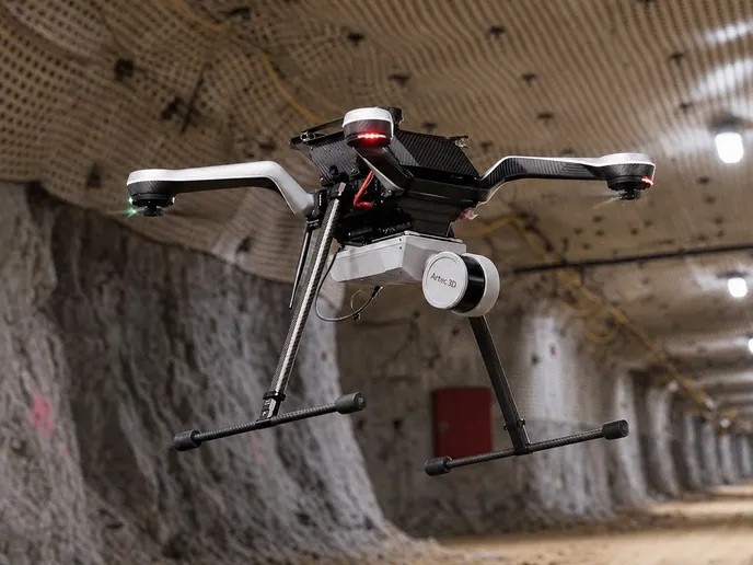
Yes, and that is the intended use rather than an edge case. Jet is designed to be carried, pole-mounted, lowered in a cage or flown, and on a drone it plans its own flight path, avoiding obstacles as fine as 2 mm wires. Shafts, ore passes, ventilation raises and sealed-off workings are the jobs it exists for.
How accurate is it compared with our total station?
A total station is more accurate per point; the scanner is accurate for the whole surface. Jet holds ±10 mm underground and ±5 mm on change detection between scans — enough to reconcile a stope, check a profile against design or see a back closing, while recording every square metre instead of the points someone chose to shoot.
Will it survive the environment?
Jet is rated IP65 and runs from −10 °C to +45 °C, with about 16 hours of capture on its 512 GB of onboard storage. LiDAR brings its own light, so a dark heading or a stope with no lighting scans the same as a lit one.
Which software do we need, and does it reach our planning package?
Artec Twins handles the large Jet and Ray II datasets, merges Leo scans where fine detail is needed, and exports LAS, LAZ and E57 point clouds and standard meshes. Those open in Maptek Vulcan, Deswik, Micromine, GEOVIA Surpac and Leapfrog as they are.
How long until our own crew is productive with it?
Days. On the surface and plant side, Element’s scanning engineer worked independently after two days of supervised practice, and there is nothing underground that changes that: the device has no set-up sequence to learn, and the processing is the same Artec software.
Other areas of mine surveying

Tell us what you need to survey underground
Describe the opening, the access you get to it and where the data has to end up. A mining specialist will come back with the deployment that fits — walked, pole-mounted, caged or flown — and the accuracy you can expect from it.