
Open-pit mine surveying and mapping
A surface mine is measured for money and for safety in the same week: the stockpile that gets invoiced, the highwall that has to be watched, the bench that has to match design, the dump that has to hold. Each has been a survey crew walking ground that is either loose, live or both.
Twelve surface jobs below, from a stockpile volume to a tailings facility.

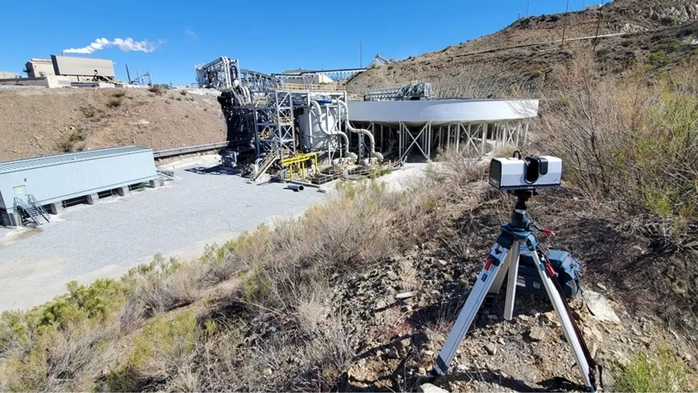
 From a safe stand-offRay II measures out to 130 m from a tripod — off the bench, off the dump, off the wall.
 1.9 mm at 10 mSurvey-grade geometry for volumes that get invoiced and slopes that get signed off.
 On mine gridArtec Twins adds GNSS georeferencing on surface, so every capture lands in the pit coordinate system.
 Into the planLAS, LAZ and E57 into Vulcan, Deswik, Micromine, Surpac or Leapfrog, as they are.
Volumes and reconciliation
The jobs where the survey becomes a number somebody invoices, reports or defends.
Walls, slopes and ground
The jobs where the question is whether something is moving, and how fast.
Design and survey
The jobs that keep the pit on design and the site model current.
Why the surface survey is a safety job as much as a measuring one
The things that have to be measured in an open pit are the things people should stay away from. A stockpile is walked to shoot its toe and crest, and stockpiles slump. A highwall is monitored from the bench below it, which is where the rock lands. A dump face is surveyed from its edge, a tailings beach from a surface that may not hold a person, a blast muck pile before it is settled. GNSS on a pole gives a point every few metres where someone can safely stand; a total station needs line of sight and an operator at the instrument for as long as the survey lasts.
A long-range scanner measures all of it from a tripod at a safe distance. Artec Ray II records everything in a 360° × 300° view out to 130 m at 1.9 mm at 10 m — the whole stockpile, the whole wall, the whole dump face — in under two minutes per station, with nobody on the ground being measured. Artec Twins georeferences the captures with GNSS so they land in pit coordinates, and exports LAS, LAZ or E57 into the planning package. Where the ground is too large or too remote for a tripod, Artec Jet on a vehicle or a drone covers it at ±15 mm.
Measured, not asserted
One capture, every surface question

Volumes: Stockpiles, dumps and blast muck as closed surfaces against a base, ready to invoice or reconcile.

Slope change: Two scans of a wall overlaid: movement, tension cracks and rockfall scars as a coloured difference.

Design conformance: Bench crest, toe and berm width against the design, section by section.

A current site model: The pit as it is this week — topography, roads and infrastructure — for planning and for the model.
See a stockpile, a bench and a highwall measured from one tripod position in an afternoon, with the volumes and the slope comparison on mine grid — book a demo for your survey team.
Book a demoQuestions that come up before the first job
How does a scan compare with GNSS on a pole for volumes?
GNSS gives a point wherever someone can safely stand — every few metres, and not on the face. A scan records the whole surface at 1.9 mm at 10 m from a tripod off the pile, so the volume is computed from millions of measured points rather than interpolated between a few dozen, and nobody walks the stockpile.
What range do we actually get on a pit wall?
Ray II measures to 130 m, at 5.3 mm accuracy at 40 m. A wall is normally captured from two or three positions on the opposite side or the bench below, and the stations register into one surface in Artec Twins.
How is the capture put on mine grid?
Artec Twins adds GNSS georeferencing on surface, so each station lands in the pit coordinate system; existing survey control is used where it is available. Exports go out as LAS, LAZ or E57 in mine grid.
Can it be used in bright sun, dust and rain?
Ray II is a laser scanner, rated IP54 and −5 °C to +40 °C; it is unaffected by daylight. Heavy dust and rain degrade any optical measurement, and the scan is timed accordingly — the station itself takes under two minutes.
Which software, and does it reach our planning package?
Artec Twins handles the large Ray II and Jet datasets, georeferences them and exports LAS, LAZ, E57 and standard meshes. Maptek Vulcan, Deswik, Micromine, GEOVIA Surpac and Leapfrog read them directly.
What about very large areas — a whole pit or a dump complex?
Artec Jet on a vehicle or a drone covers ground at ±15 mm without stopping, and registers into the same model as the Ray II stations. Most surface operations run both: Ray II where the accuracy is invoiced, Jet where the area is.
Other areas of mine surveying
Tell us what you need to survey on surface
Describe the asset, the stand-off you can get and where the data has to end up. A mining specialist will come back with the scanner that fits it, the accuracy you can expect at that distance, and how the data lands in your planning package.