
Underground face and geological mapping
Geological mapping underground is a geologist at the face with a compass, a notebook and a light, in the window between the muck being cleared and the drill arriving. What gets mapped is what there was time for, from where it was safe to stand.
A scan of the face and walls takes the window down to minutes and gives the geologist a georeferenced surface to map from at the desk — every contact and structure in mine grid, with the face still there to re-examine after the next round has taken it.
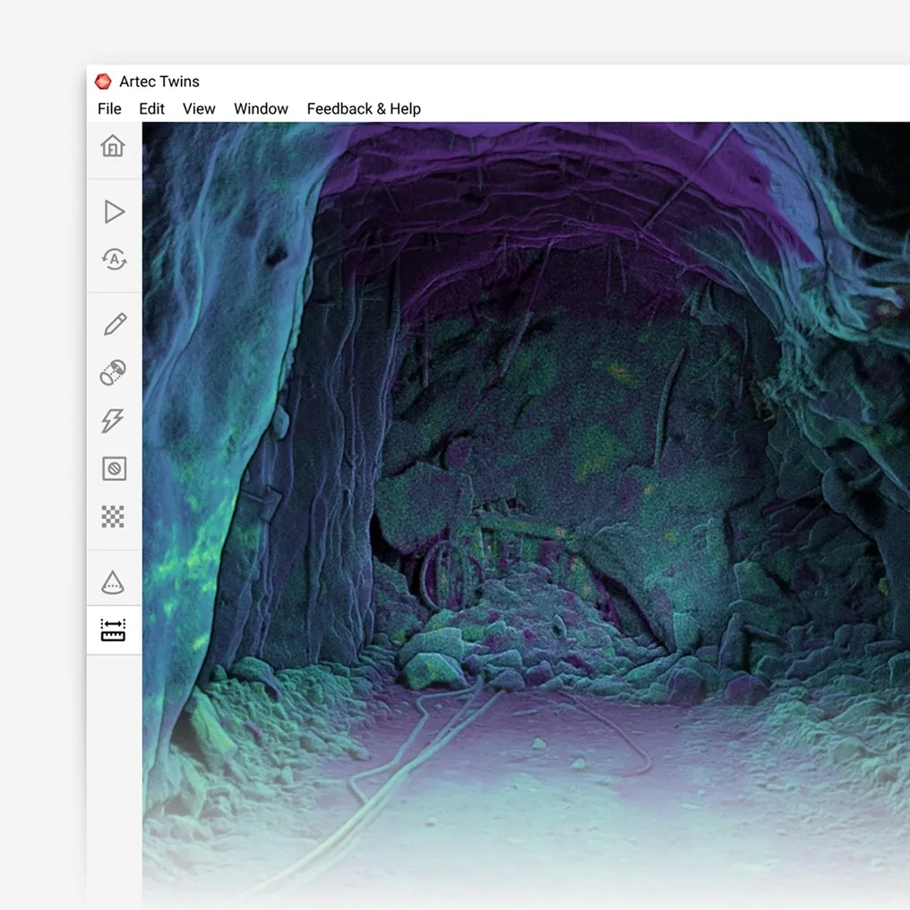
Can geological face mapping be done from a 3D scan?
Yes — the face is captured as a georeferenced surface at ±10 mm in minutes, and contacts, structures and lithology are mapped on the model in mine grid.
 Structure in mine gridContacts, joints and faults digitised on the surface with true orientation.
 Minutes at the faceThe capture fits the window between mucking and drilling.
 The face keptRe-examine a face weeks after the round that removed it.
 Continuous modelFaces and walls accumulate into a geological as-built of the whole drive.
Why face mapping is a compromise every round
The face exists for one cycle. Between the muck being cleared and the drill jumbo arriving, a geologist has a window — sometimes minutes — to record contacts, structure and lithology from a face that is dusty, unevenly lit and, until it has been scaled and supported, not somewhere to stand for long. The mapping is a sketch with a few compass readings, tied to a survey point by pacing. The next round takes the face away, and the record is whatever was written down.
The compromise compounds. Faces mapped in a hurry by different geologists in different light produce a structural record that is inconsistent along the drive. A contact that appears to shift between rounds may have shifted or may have been mapped from a different position. Resource geologists and geotechnical engineers work from that record without being able to go back to the rock.
A scanned face changes the window into a permanent record. Artec Jet captures the face and walls at ±10 mm in minutes, in whatever light there is, and Artec Twins places the surface in mine grid. Mapping is done on the model, at the desk, with time: contacts and structures are digitised on the surface with true orientation, the same face is re-examined weeks later, and every mapped face accumulates into a continuous geological as-built of the drive.
From face to mapped surface
Minutes at the face; the mapping happens where there is time.
 1. Capture the faceJet records the face and adjacent walls at up to 1.9 million points per second, in the window between mucking and drilling.
 2. Place in mine gridTwins registers the capture to survey control so every point on the face has true coordinates.
- 3. Map on the modelContacts, joints, faults and lithology digitised on the surface with orientation measured, not paced.
- 4. AccumulateEach face joins the previous ones into a continuous structural and lithological record of the drive.
 5. ExportSurfaces and mapped structures into Leapfrog, Vulcan or the geological package as LAS, LAZ, E57 or meshes.
Which scanner for this work
The face is a large, dark, unevenly lit surface that has to be captured fast; the fine mineralogy still needs a geologist’s eye and, where wanted, a close-range scanner.
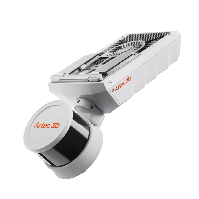
Artec Jet
- Best for
- The face and walls in mine grid, in minutes, every round
- Type
- Multi-modal SLAM LiDAR
- Accuracy, up to
- ±10 mm underground, ±15 mm general
- Change detection
- ±5 mm
- Range
- 0.5–300 m
- Positional drift
- ±0.03%
- Deployment
- Handheld, backpack, pole, drone, vehicle, cage, robot
Jet captures the whole face and the drive around it at ±10 mm without set-up or light, in the time the window allows. Its 360° × 290° field of view takes in back and walls with the face, so structure can be traced around the drive, and every capture is tied to mine grid through survey control.
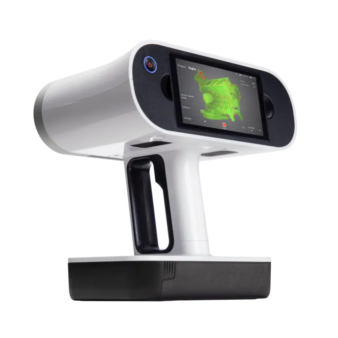
Artec Leo
- Best for
- Close-range detail of a contact, vein or structure at 0.1 mm
- Type
- Wireless handheld structured light, all-in-one
- 3D point accuracy, up to
- 0.1 mm
- 3D resolution, up to
- 0.2 mm
- Working distance
- 0.35–1.2 m
- Capture speed
- Up to 35,000,000 points/s in HD Mode
- Onboard
- 5.5″ touchscreen, processing and 512 GB — no laptop
Where a specific structure or contact matters — a vein margin, a fault gouge, a texture that decides the interpretation — Leo records it at 0.1 mm with 2.3 MP colour texture, wirelessly and with its screen and processing onboard. The detail scan registers into the Jet capture so it sits in mine grid with everything else.
See a face captured in minutes and mapped at the desk in mine grid, still there after the next round has taken it — book a demo for your geology team.
Book a demoQuestions mine geologists ask
Can structure orientation be measured from the scan?
Yes. The surface is in mine grid at ±10 mm, so a plane fitted to a joint or contact on the model has a true dip and dip direction, measured rather than read off a compass at arm’s length.
Does it capture colour and texture for lithology?
Jet records geometry and intensity; Leo adds 2.3 MP colour texture at 0.1 mm for the detail that decides a lithological call. Most face mapping runs on the Jet surface with Leo brought in where the texture matters.
How long does the geologist spend at the face?
The time to capture — minutes — rather than the time to map. The mapping moves to the desk, where the surface can be examined from any angle and revisited after the round has taken the face.
Does the mapped data reach our geological package?
Surfaces and digitised structures export as LAS, LAZ, E57 and standard meshes, which Leapfrog, Maptek Vulcan and the other planning packages read directly.
Related applications

Tell us about your face mapping
Describe the development, how faces are mapped today and what the resource and geotechnical teams need from the record. A mining specialist will come back with what a scanned face gives each of them.