
Mine convergence monitoring and change detection
Convergence has been monitored at points: tape extensometers between pins, prisms read by a total station, instruments where someone decided movement was likely. Everything between the points is assumed to behave the same way, and the failure that matters is usually where nobody put an instrument.
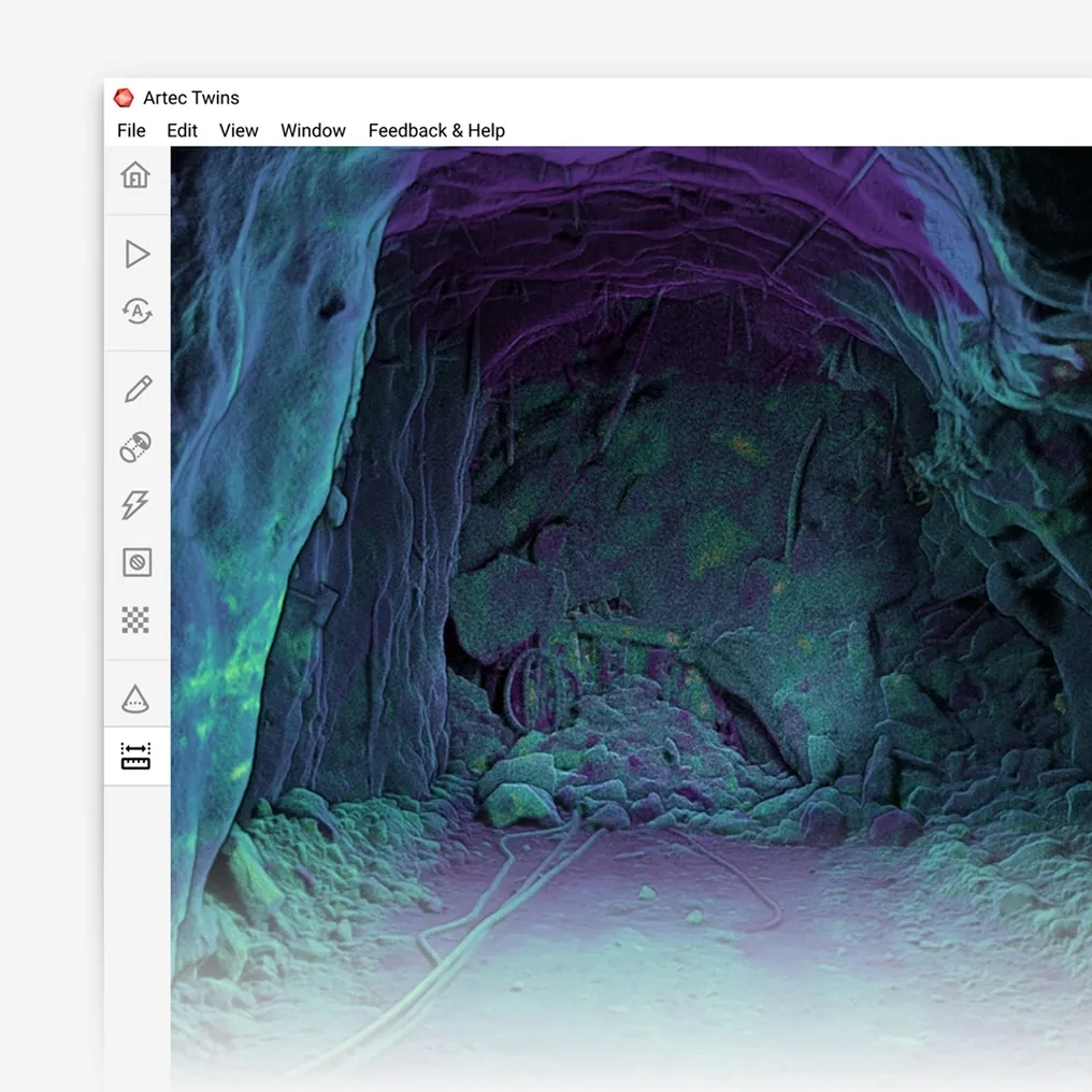
Two scans of the same excavation, overlaid, show movement across the entire surface at ±5 mm — the back, the walls, the pillar — as a coloured difference, including the places nobody thought to instrument.
Can 3D scanning monitor convergence in a mine?
Yes — two SLAM LiDAR scans of the same excavation overlaid at ±5 mm show movement across the whole surface, not only at prisms, wherever it occurs.
 ±5 mm change detectionTwo epochs overlaid, with the difference coloured by distance.
 The whole surfaceBack, walls, floor and pillars — no gap between instruments.
 Repeatable in minutesA monitored section re-scanned at walking pace, as often as the plan needs.
 Nobody under the backThe reading is taken from the scan, not from a pin at the roof.
Why point monitoring misses what it is looking for
Convergence instrumentation is a bet on where the ground will move. Pins, prisms and extensometers are installed where the geotechnical engineer expects closure — a pillar nose, a wide intersection, a section of drive in poor ground — and read on a schedule. The readings are accurate and the bet is usually right, but a heading has hundreds of square metres of surface and the instruments cover a few points on it. Movement between the points, or in a section nobody flagged, is not measured at all.
Reading the instruments is also exposure. Tape extensometers are read at the pins, prisms have to be installed at the back, and the sections that need monitoring most are the ones where standing under the roof is least comfortable. The schedule is a compromise between how often the data is wanted and how often someone can be sent to get it.
A scan monitors the surface rather than points on it. Artec Jet records the excavation at walking pace, at ±10 mm and with no set-up; a second scan weeks later is overlaid on the first in Artec Twins and the difference is shown at ±5 mm as a coloured surface. Closure in the back, movement on a pillar face, floor heave — wherever it is, it is in the difference, with a magnitude, and the reading was taken from the drive rather than from under the roof.
From baseline to change map
The first scan is the baseline; every later one is compared with it.
- 1. Baseline scanJet records the monitored section at ±10 mm, tied to survey control, as part of the normal pick-up.
 2. Fix the frameThe capture is registered to stable control outside the moving ground so later scans compare against a fixed reference.
- 3. Re-scan on scheduleThe same section walked again — weekly, monthly, after a seismic event — in minutes.
- 4. OverlayTwins compares the epochs and colours the difference by distance at ±5 mm across the whole surface.
 5. ReportChange surfaces, sections and magnitudes into the geotechnical package; prisms stay where a point time-series is wanted.
Which scanner for this work
Convergence is a repeat survey of a whole surface, which is the SLAM scanner’s job; where a single point needs millimetre precision, the long-range scanner adds it.
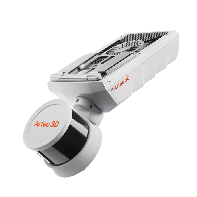
Artec Jet
- Best for
- The monitored excavation, re-scanned at walking pace and compared at ±5 mm
- Type
- Multi-modal SLAM LiDAR
- Accuracy, up to
- ±10 mm underground, ±15 mm general
- Change detection
- ±5 mm
- Range
- 0.5–300 m
- Positional drift
- ±0.03%
- Deployment
- Handheld, backpack, pole, drone, vehicle, cage, robot
Jet’s ±5 mm change detection is the figure this job runs on. Because it surveys at walking pace with no set-up, the monitored section can be re-scanned as often as the geotechnical plan wants, and its 360° × 290° field of view means the back, both walls and the floor are compared together. Sixteen hours of onboard capture cover a full monitoring round.
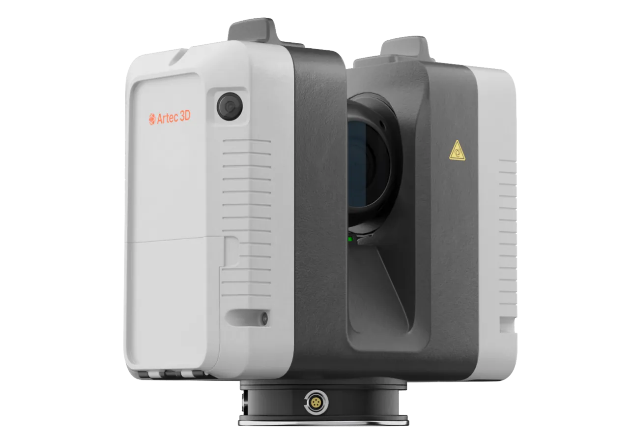
Artec Ray II
- Best for
- A critical pillar or intersection where 1.9 mm at 10 m is wanted
- Type
- Stationary long-range laser, tripod mounted
- Accuracy, up to
- 1.9 mm at 10 m, 2.9 mm at 20 m, 5.3 mm at 40 m
- Range noise
- 0.4 mm at 10 m
- Range
- 0.5–130 m
- Scan time
- 1 min 42 s at 3 mm, 10 m, without texture
- Field of view
- 360° × 300°
Where one structure justifies survey-grade precision — a crown pillar, a main intersection, a section under a repair — Ray II on a tripod records it at 1.9 mm at 10 m with 0.4 mm range noise, so smaller movements read as signal. It registers into the Jet model and is repeated from the same position each epoch.
See two scans of a heading overlaid, with the closure in the back coloured at ±5 mm where no prism was installed — book a demo for your geotechnical team.
Book a demoQuestions geotechnical engineers ask
How does ±5 mm compare with our extensometers?
An extensometer is more precise at its pin; the scan is ±5 mm everywhere. The two are complementary: prisms and pins give a time-series at chosen points, the scan shows where movement is happening across the surface, including where no instrument was placed.
How do you know the scanner itself is not what moved?
Each scan is registered to survey control outside the moving ground, so both epochs share a fixed frame. The difference between them is ground movement, not scanner position.
How often can we re-scan?
As often as someone can walk the section. A monitored heading is re-scanned in minutes with no set-up, so weekly rounds, or a scan after a seismic event, are practical rather than a special exercise.
Does it replace our monitoring instruments?
It removes the gaps between them. Instruments stay where a continuous or high-precision time-series is needed; the scan covers everything else and tells you where the next instrument should go.
Related applications

Tell us what ground you are watching
Describe the excavations under monitoring, the instruments in place and what the geotechnical plan needs to see. A mining specialist will come back with how a scan round would run and what the change maps would add.