
Tailings storage facility survey and monitoring
A tailings facility is surveyed for the things that decide whether it is safe: embankment geometry, freeboard, beach slope, and whether any of it is moving. The beach cannot be walked, the downstream face is the one part that must not be disturbed, and the record has to satisfy an engineer of record and a regulator.
From the crest road or the toe, a long-range scanner records the embankment and beach as one surface; scan to scan, settlement and movement show across the whole structure, and the freeboard is a measurement along the entire crest.
How is a tailings facility surveyed without walking the beach?
From the crest road or the toe a long-range scanner records embankment, beach and pond edge at 5.3 mm at 40 m; freeboard is measured along the whole crest.
 Embankment as builtCrest, downstream face and toe as one measured surface, section by section.
 Freeboard everywhereCrest level against pond level along the full length, not at a few pegs.
 Settlement and movementTwo epochs overlaid show where the crest has settled or the face has moved.
 A record that standsDated, complete surfaces for the engineer of record and the regulator.
Why the TSF record is the one under most scrutiny
Since the failures of the last decade, a tailings facility is the most audited structure on a mine. The engineer of record wants the embankment geometry as built and as it changes, freeboard along the crest, beach slope and pond position, and evidence that movement is being watched. What the survey has been able to give is GNSS along the crest road, a few sections down the downstream face where it is safe to walk, and piezometers and survey pegs at chosen points. The beach is not walked. The record is a set of lines and points on a structure hundreds of metres long.
Freeboard is the number that matters most and it is measured least. A crest survey every few months and a pond level reading give freeboard at the pegs; between them the crest may have settled, and a low point in the crest is exactly what a freeboard survey exists to find. Movement of the downstream face — the early sign of the failure everyone is guarding against — is caught by pegs if it happens at a peg.
A long-range scanner records the structure. Artec Ray II from the crest road, the toe or the abutments captures the embankment, the beach and the pond edge at 5.3 mm at 40 m, out to 130 m, in under two minutes per station; Artec Twins registers the stations on mine grid with GNSS. Freeboard is the crest surface against the pond level along the entire length, the downstream face is sectioned wherever the engineer wants, and each survey is overlaid on the last so settlement and movement show as a coloured difference across the whole structure. The record is a dated surface, complete, that a regulator can inspect.
From crest road to a record the engineer of record can sign
Nobody steps onto the beach or the downstream face.
 1. Scan from the crest and the toeRay II stations along the crest road for the beach and pond edge; at the toe and abutments for the downstream face.
 2. GeoreferenceTwins registers everything on mine grid with GNSS and the facility’s survey control.
- 3. Freeboard and sectionsCrest level against pond level along the full length; sections down the face at the engineer’s spacing.
- 4. Compare with last surveySettlement of the crest and movement of the face as a coloured difference with magnitudes.
 5. ReportSurfaces, sections, freeboard and change maps to the engineer of record; LAS, LAZ or E57 into the site model.
Which scanner for this work
The structure has to be measured from a distance to survey-grade, and it is long. One device for each requirement.
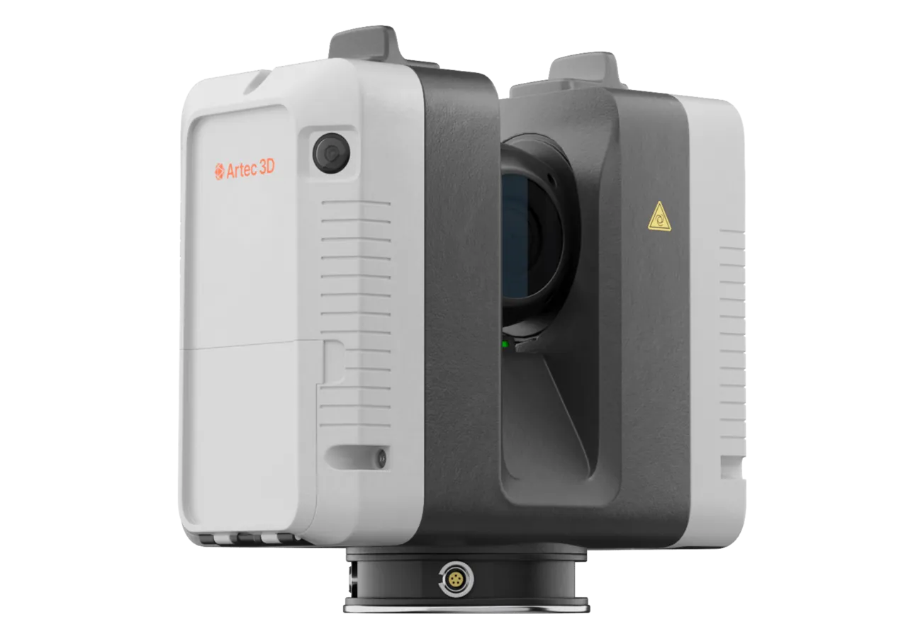
Artec Ray II
- Best for
- Embankment faces, beach and pond edge from the crest road or the toe
- Type
- Stationary long-range laser, tripod mounted
- Accuracy, up to
- 1.9 mm at 10 m, 2.9 mm at 20 m, 5.3 mm at 40 m
- Range noise
- 0.4 mm at 10 m
- Range
- 0.5–130 m
- Scan time
- 1 min 42 s at 3 mm, 10 m, without texture
- Field of view
- 360° × 300°
Ray II reaches 130 m from a tripod at 5.3 mm at 40 m with 0.4 mm range noise, so a beach and a downstream face are recorded from the road at the accuracy a freeboard measurement or a movement comparison needs. Stations take under two minutes; a full facility is a morning.
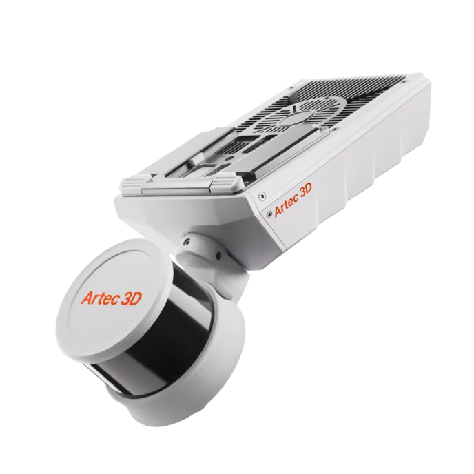
Artec Jet
- Best for
- The crest road and long embankments, driven
- Type
- Multi-modal SLAM LiDAR
- Accuracy, up to
- ±10 mm underground, ±15 mm general
- Change detection
- ±5 mm
- Range
- 0.5–300 m
- Positional drift
- ±0.03%
- Deployment
- Handheld, backpack, pole, drone, vehicle, cage, robot
On a vehicle along the crest road, Jet records the crest and the upper face at ±15 mm without stopping, kilometres of embankment in a pass. It registers into the same Twins model as the Ray II stations, so the critical sections get the tripod and the whole crest gets a freeboard check every time the road is driven.
See a tailings embankment and its beach recorded from the crest road, with freeboard along the whole crest and the settlement since the last survey — book a demo for your TSF engineer.
Book a demoQuestions tailings engineers ask
Will the engineer of record accept a scan-based survey?
A scan gives them what they ask for and have rarely had: the complete embankment geometry as a dated surface, freeboard along the entire crest and a change map against the previous survey. What the engineer of record requires is their decision; the scan removes the gaps in the record they usually have to qualify.
Can it measure the beach and the pond edge?
The beach is a surface and the pond edge is where that surface meets water; both are recorded from the crest road at range. The beach slope and the pond position come from the scan without anyone on the tailings.
How does it detect movement of the downstream face?
By overlaying successive scans from the same positions. Movement shows as a coloured difference with magnitude across the whole face rather than at survey pegs, and it is located wherever it is.
How often can the facility be surveyed?
As often as the road can be driven and a few stations set up. With a full survey taking a morning, the interval is set by the monitoring plan rather than by what the survey crew can manage.
Related applications

Tell us about your tailings facility
Describe the facility, the monitoring plan and what the engineer of record asks for. A mining specialist will come back with how the survey would run from the crest and the toe and what the record would contain.