
Haul road surveying and road conformance
A haul road is designed to a grade, a crossfall, a width and a windrow height, and it drifts from all four under the trucks. Checking it has meant a surveyor on the road with a GNSS pole and a light vehicle in the haulage cycle, shooting sections where it is safe to stop.
Scanned from a vehicle driving the road in traffic, the whole road is a surface — grade and crossfall at every metre, width and windrow height along its length, and the potholes and soft spots where the surface has moved since last week.
How is a haul road surveyed without closing it?
A SLAM LiDAR scanner on a vehicle records the whole road at ±15 mm in traffic; grade, crossfall, width and windrow height are measured at every metre.
 Surveyed while drivingThe scanner on a vehicle in the haulage cycle; no closure, no stopping.
 Every metreGrade, crossfall, width and windrow height as continuous measurements, not spot sections.
 Against the designWhere the grade exceeds the standard and where the crossfall has reversed.
 Since last weekPotholes, rutting and soft spots as change against the last pass.
Why the road is checked where the surveyor could stop
Haul road conformance has been spot sections. A surveyor drives to a section, stops where it is safe to, and shoots a profile across the road with a GNSS pole while trucks pass. Grade is the difference between two sections; crossfall is the profile at one; width is the two edges; windrow height is a shot on top and one at the base. The sections are where it was safe to stop, which is not where the road is worst, and the road between them is assumed to conform.
A road that does not conform costs tyres, fuel and cycle time, and it is the site of most of the mine’s vehicle incidents. Grade over the standard on a loaded haul, crossfall that has reversed so water pools, a windrow that has been pushed down by a grader below the height a tyre needs — each is a defect that the spot sections miss unless they happen to land on it, and each is found by the truck.
A scanner on a vehicle surveys the whole road. Artec Jet mounted to a light vehicle records the surface, the edges and the windrows at ±15 mm as it drives the road in the normal traffic, with no stopping and no GPS needed for positioning; Artec Twins georeferences the pass on mine grid. Grade and crossfall are measured at every metre, width and windrow height along the full length, all against the road design standard — and a pass a week later, overlaid, shows where the surface has moved.
From a drive to a conformance report
The survey is a drive along the road at normal speed in the traffic.
- 1. Drive the roadJet on a light vehicle records the surface, edges and windrows at ±15 mm without stopping.
 2. GeoreferenceTwins places the pass on mine grid with GNSS, so every metre has true coordinates and elevation.
- 3. Measure every metreGrade, crossfall, width and windrow height as continuous profiles along the road.
- 4. Compare with the standardSections exceeding grade, reversed crossfall, narrow width or low windrow flagged with location.
- 5. Compare with last passPotholes, rutting and soft spots as change since the last drive; the grader’s work list.
Which scanner for this work
A haul road is surveyed at driving speed, which is the mobile scanner’s job.
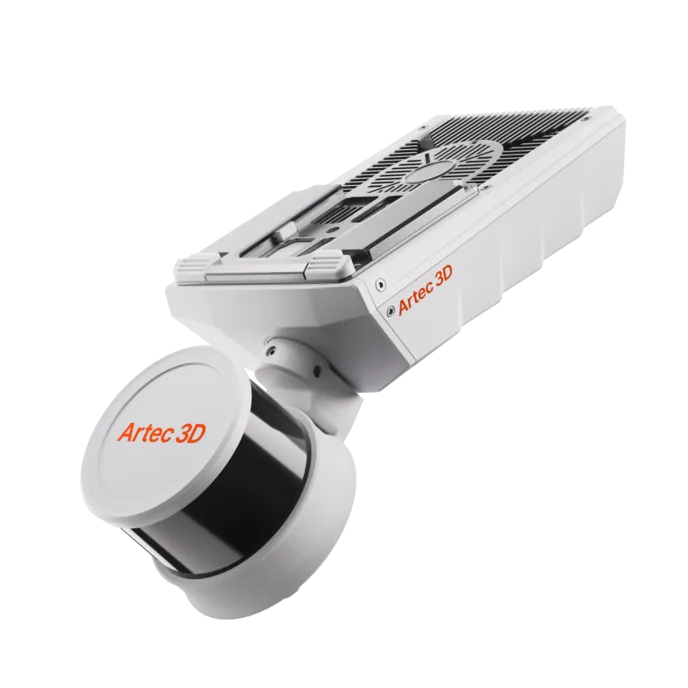
Artec Jet
- Best for
- The whole haul road network, driven in traffic
- Type
- Multi-modal SLAM LiDAR
- Accuracy, up to
- ±10 mm underground, ±15 mm general
- Change detection
- ±5 mm
- Range
- 0.5–300 m
- Positional drift
- ±0.03%
- Deployment
- Handheld, backpack, pole, drone, vehicle, cage, robot
Jet on a vehicle records the road at ±15 mm on surface as it is driven, holding ±0.03% drift between GNSS fixes, with 16 hours of onboard capture — the whole network in a shift, without a closure. Its 360° × 290° field of view takes in both edges and both windrows with the surface, so width and windrow height come out of the same pass as grade and crossfall.
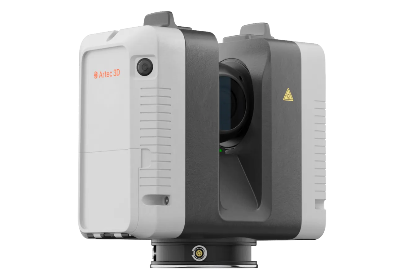
Artec Ray II
- Best for
- Intersections, ramps and a road section under dispute, at survey-grade
- Type
- Stationary long-range laser, tripod mounted
- Accuracy, up to
- 1.9 mm at 10 m, 2.9 mm at 20 m, 5.3 mm at 40 m
- Range noise
- 0.4 mm at 10 m
- Range
- 0.5–130 m
- Scan time
- 1 min 42 s at 3 mm, 10 m, without texture
- Field of view
- 360° × 300°
Where one section of road has to be measured to the millimetre — a ramp grade under dispute, an intersection redesign, a section after a repair — Ray II on a tripod records it at 1.9 mm at 10 m in under two minutes, and the driven Jet survey registers into it.
See a haul road’s grade, crossfall and windrow height measured at every metre from one drive in traffic, with the grader’s work list from the change since last week — book a demo for your road maintenance supervisor.
Book a demoQuestions road maintenance supervisors ask
Does the survey need the road closed?
No. The scanner rides a light vehicle in the normal traffic at normal speed. Trucks in view are removed in processing; the road is measured as it stands.
How accurate is the grade?
The surface is recorded at ±15 mm and georeferenced on mine grid, so grade over any interval and crossfall at any section are measured to well inside what a road design standard specifies.
Can it measure windrow height?
Yes. The windrow is in the scan as a surface on both sides of the road, and its height above the running surface is measured along the full length — the check that matters for tyre-height compliance.
How do we use the weekly change?
As the maintenance list. Overlaying this week’s pass on last week’s shows where the surface has dropped, rutted or pooled, with location and magnitude, so the grader goes where the road has moved rather than along its usual route.
Related applications

Tell us about your haul road network
Describe the network, the design standard and how conformance is checked today. A mining specialist will come back with how a driven survey would run and what the weekly report would contain.