
Stope scanning and stope reconciliation
A stope is the one excavation on the mine nobody is allowed to stand in and everybody has to measure. Reconciliation, dilution, overbreak, the tonnes actually drawn against the tonnes planned — all of it rests on knowing the shape of a void that can only be seen from its edges.
A SLAM LiDAR scanner goes in on a pole, in a cage or on a drone, records the whole cavity at ±10 mm, and comes back as a closed solid the planning package can reconcile the same shift.
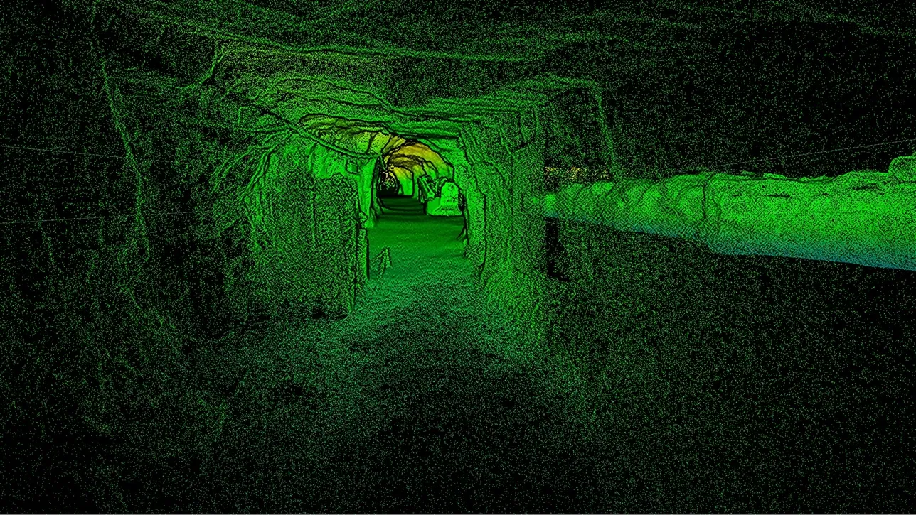
Can a stope be surveyed without entering it?
Yes — the scanner is lowered, extended or flown into the void, captures every wall at ±10 mm without GPS or targets, and returns a closed solid ready for reconciliation.
 Nobody under the browPole, cage or drone deployment from the drawpoint or the drill drive.
 A closed solidThe full void volume, not a stitched estimate from a few range shots.
 Dilution made visibleThe as-mined shape against the design stope, coloured by distance.
 Reconciled in your packageThe solid opens in Vulcan, Deswik, Micromine or Surpac as it is.
Why stope reconciliation has always been an estimate
The stope is measured from outside, so the measurement has always been partial. A cavity monitoring boom reaches a set distance from the access point and sees what is in its line of sight; the far wall, the back of an irregular cavity and anything behind a shoulder are inferred. The reconciliation that follows compares a planned solid with an estimated one, and the difference — dilution, overbreak, unbroken ground — inherits the uncertainty.
The consequence is commercial. Mined tonnes reported against the plan drive the mill feed forecast, the grade reconciliation and, at the end of the month, a number somebody has to defend. When the void was only partly seen, the number is only partly known, and the argument about whether the stope overbroke or the plan was wrong cannot be settled from the data.
A scanner that enters the void changes what is measured. Artec Jet on a pole, in a cage or on a self-navigating drone records the cavity from inside at ±10 mm, with 360° × 290° of view and no GPS, so the back, the far wall and the ground behind the shoulder are surfaces rather than gaps. The result is a closed solid that Vulcan, Deswik or Surpac reconciles directly against the design — the same package, the same workflow, a measured shape instead of an estimated one.
From drawpoint to reconciled solid
Nobody crosses the brow at any step.
 1. Set up at the edgeFrom the drawpoint or the drill drive, choose the deployment: pole for a shallow void, cage for a deep one, drone for a large or irregular one.
 2. Enter and captureJet records the cavity at up to 1.9 million points per second, planning its own route on a drone and avoiding obstacles as fine as a 2 mm wire.
 3. Register and closeArtec Twins registers the capture to the access drive and closes the void as a watertight solid.
- 4. Compare to designThe as-mined solid against the design stope, with overbreak and unbroken ground coloured by distance.
- 5. ReconcileExport the solid and point cloud as LAS, LAZ or E57 into the planning package for the tonnes and grade reconciliation.
Which scanner for this work
One device does this job: the one that can go into the void.
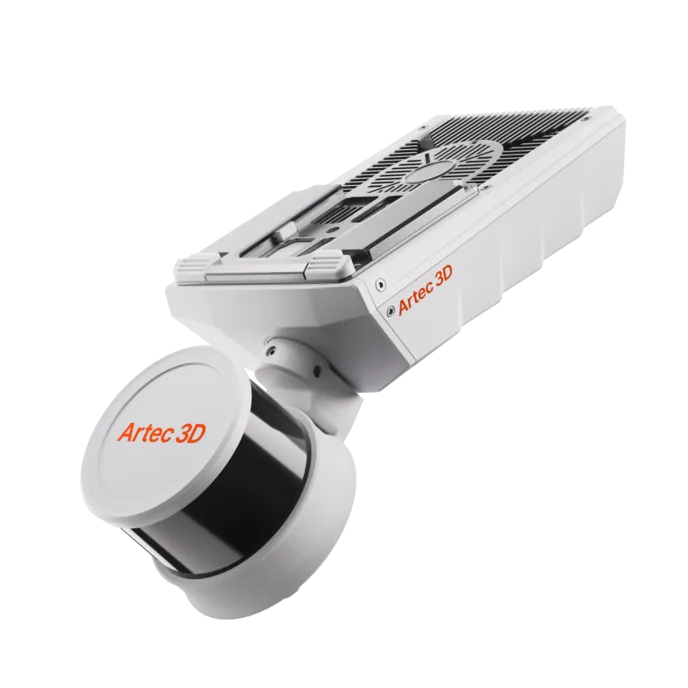
Artec Jet
- Best for
- The stope itself — entered on a pole, in a cage or on a drone
- Type
- Multi-modal SLAM LiDAR
- Accuracy, up to
- ±10 mm underground, ±15 mm general
- Change detection
- ±5 mm
- Range
- 0.5–300 m
- Positional drift
- ±0.03%
- Deployment
- Handheld, backpack, pole, drone, vehicle, cage, robot
Jet is the scanner that goes where the surveyor cannot. On a drone it plans its own flight path through the cavity; on a pole or in a cage it is lowered past the brow and records a full 360° × 290° view from inside. At ±10 mm underground and with about 16 hours of onboard capture, one deployment covers a stope and the drive that reaches it.
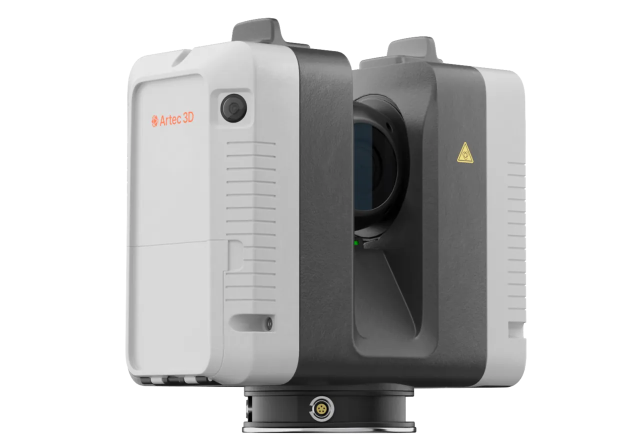
Artec Ray II
- Best for
- The drawpoint and the drive at survey-grade, and a line-of-sight check of a simple stope from the brow
- Type
- Stationary long-range laser, tripod mounted
- Accuracy, up to
- 1.9 mm at 10 m, 2.9 mm at 20 m, 5.3 mm at 40 m
- Range noise
- 0.4 mm at 10 m
- Range
- 0.5–130 m
- Scan time
- 1 min 42 s at 3 mm, 10 m, without texture
- Field of view
- 360° × 300°
Ray II on a tripod at the drawpoint records the access drive at 1.9 mm at 10 m and, where a stope is simple and open to view, captures what is in line of sight from the brow in under two minutes. It is the survey-grade frame the Jet capture of the void registers into.
See a stope scanned from the drawpoint and reconciled against its design before the shift ends — book a demo for your survey team.
Book a demoQuestions surveyors ask
How is this different from a cavity monitoring system?
A CMS boom measures from a fixed point at the access and sees what is in its line of sight. A scanner that enters the void records the far wall, the back and anything behind a shoulder as surfaces. The difference is the part of the reconciliation that used to be inferred.
What accuracy does the reconciliation get?
±10 mm on the void surface underground, with ±5 mm change detection between two captures of the same stope. That is well inside what tonnes and dilution reconciliation needs, and far more surface than any boom-based method records.
Can the drone fly in a stope with no light and hanging wires?
Yes. LiDAR provides its own signal, so darkness is irrelevant, and the drone plans its own path around obstacles as fine as 2 mm wires — ventilation bag ties and blasting cable are exactly what it is designed to avoid.
Does the solid open in our planning package?
Artec Twins exports LAS, LAZ and E57 point clouds and standard meshes. Maptek Vulcan, Deswik, Micromine, GEOVIA Surpac and Leapfrog read them directly; the reconciliation runs where it always has.
Related applications

Tell us about the stopes you reconcile
Describe the stoping method, the access you get to the void and the package you reconcile in. A mining specialist will come back with the deployment that fits and what a scan of your stope would return.