
SLAM LiDAR for underground mining
Every point a moving scanner records is only as good as its knowledge of where it was when it recorded it. On surface that knowledge comes from satellites. Underground it has to come from somewhere else, and SLAM — simultaneous localisation and mapping — is the somewhere else.
The scanner builds a map of the geometry around it and positions itself against that map, at the same time, holding ±0.03% positional drift, and the underground survey stops needing a set-up.
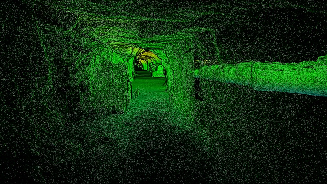
What is SLAM LiDAR and why does mining use it?
SLAM lets a moving scanner position itself from the geometry it records, with no GPS, at ±0.03% drift — so headings and stopes are surveyed without set-ups.
 Position from geometryThe rock is the reference; no satellites, no targets, no set-up.
 ±0.03% driftPosition error grows with distance travelled, and control resets it.
 Loops closeReturning to a place already scanned corrects the whole trajectory between.
 Tied to mine gridSurvey control still puts the model where the mine plan says.
How a scanner knows where it is in the dark
A LiDAR scanner measures the distance to everything around it many times a second. Stand still and that gives a scan from one known position. Start walking and each new scan overlaps heavily with the last; the geometry that appears in both — the shape of the walls, the back, a pipe, a bolt plate — tells the scanner how far and in which direction it moved between them. Chain those movements together and the scanner has a trajectory and a map, built simultaneously, with nothing but the rock as a reference. That is SLAM.
The weakness is that each estimate of movement carries a tiny error, and the errors accumulate with distance: this is drift, and Artec Jet holds it to ±0.03% — of the order of 0.3 m over a kilometre with no other information at all. Two things keep it far below that in practice. Loop closure: when the scanner returns to a place it has already scanned, it recognises the geometry and corrects the whole trajectory in between. And survey control: every known station the scanner passes is a point where drift is reset to the mine’s own coordinate system.
What this changes for the underground survey is the set-up. A tripod instrument has to be levelled and oriented off known points at every position; a SLAM scanner is carried from the collar to the face and back, or flown into a stope, and positions itself the whole way at ±10 mm underground. Artec Twins registers the trajectory to the control it passed and the result is the complete drive, floor to back, on mine grid — in the time the walk took.
How the survey is built as you walk
What happens between the collar and the face, in order.
- 1. Start on a known pointThe first scans are tied to a survey station, so the trajectory begins in mine grid.
- 2. Track movementEach scan is matched to the last on shared geometry; the offset between them is the movement.
- 3. Build the mapScans accumulate into a map of the drive at up to 1.9 million points a second, 360° × 290° around the scanner.
- 4. Close loops and hit controlRevisited geometry and passed stations correct the trajectory; drift is reset each time.
 5. Register in TwinsThe full trajectory is tied to all the control it touched; the drive is exported on mine grid as LAS, LAZ or E57.
Which scanner for this work
SLAM is a positioning method; one device on this site is built around it.
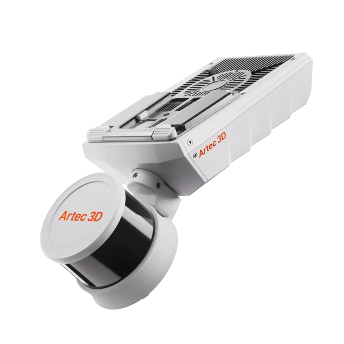
Artec Jet
- Best for
- Any underground survey that has to be done on the move, without GPS
- Type
- Multi-modal SLAM LiDAR
- Positional drift
- ±0.03%
- Accuracy, up to
- ±10 mm underground, ±15 mm general
- Change detection
- ±5 mm
- Capture speed
- Up to 1,900,000 points/s, triple return
- Field of view
- 360° × 290°
Jet is a multi-modal SLAM LiDAR scanner: it positions itself from the geometry it records, holding ±0.03% positional drift, and captures at up to 1.9 million points a second with triple return across 360° × 290°. Accuracy is ±10 mm underground, change detection ±5 mm between scans. At 1.57 kg with 16 hours of onboard storage it is carried, worn, pole-mounted, driven, caged or flown.
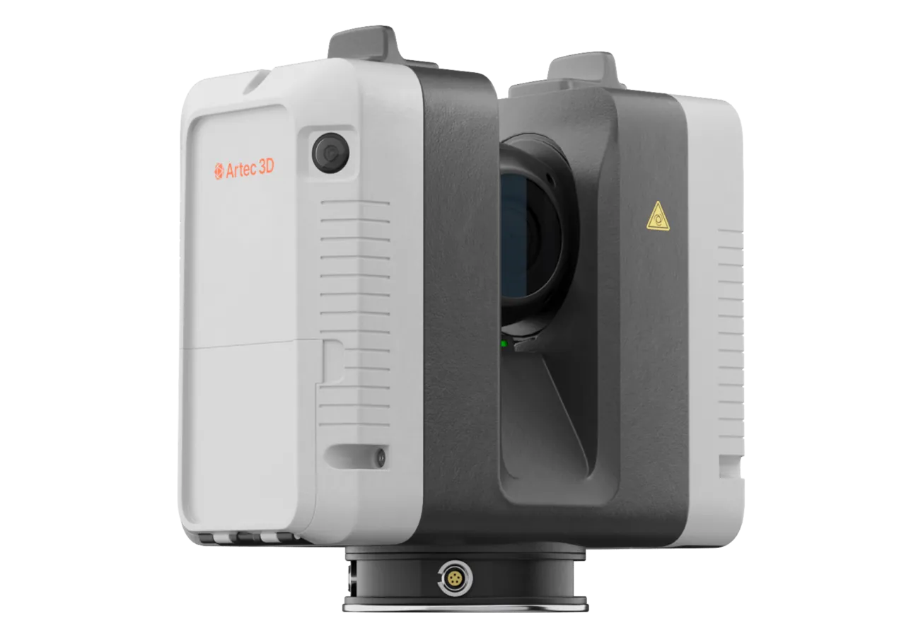
Artec Ray II
- Best for
- The survey-grade reference the SLAM trajectory is tied to
- Type
- Stationary long-range laser, tripod mounted
- Accuracy, up to
- 1.9 mm at 10 m, 2.9 mm at 20 m, 5.3 mm at 40 m
- Range noise
- 0.4 mm at 10 m
- Range
- 0.5–130 m
- Scan time
- 1 min 42 s at 3 mm, 10 m, without texture
- Field of view
- 360° × 300°
A SLAM survey is only as good as the control it is registered to, and Ray II on a tripod provides that at 1.9 mm at 10 m: a portal, a station, a chamber recorded as a fixed reference. The walked Jet trajectory registers to those captures as well as to the survey stations, and the drift is bounded by both.
See a decline walked from the portal to the face with no set-ups, and the trajectory closing on the control it passed — book a demo for your survey team.
Book a demoQuestions surveyors ask
Does SLAM replace survey control?
No — it replaces the set-up. The scanner positions itself between stations; the stations still put the model on mine grid and reset drift. A well-controlled mine gets the most from SLAM, not the least.
What happens in a featureless drive?
SLAM needs geometry to match against, and a long, smooth, straight tunnel with nothing on the walls is the hardest case. Real mine drives have services, bolts, mesh and rock texture; where a section is genuinely featureless, control at each end holds it.
How does ±0.03% compare with what we need?
Over a 500 m drive with control at both ends and a few stations between, the residual is well inside the ±10 mm surface accuracy. The figure matters most for long uncontrolled traverses — an old level, a stope interior — where it bounds the error.
Is SLAM only for underground?
No. Jet uses the same positioning on surface, where GNSS is added for georeferencing in Artec Twins. Underground is where SLAM is the only option, which is why it is explained here.
Related applications

Tell us about your underground surveys
Describe the development, the control network and how the pick-up runs today. A mining specialist will come back with how a SLAM survey would tie to your control and what it would change in the cycle.