
Mine production and end-of-month reconciliation
The month-end reconciliation compares three things that were measured three different ways: what the survey says was dug, what the fleet system says was hauled, and what the plant says it received. When they disagree — and they do — the survey is the one that can be re-checked, if the survey was complete.
When the pit, the dumps and the stockpiles are scanned as surfaces at month end, the volumes moved are the difference between two measured models, and the reconciliation compares geometry with tonnes rather than estimates with estimates.
How does 3D scanning improve end-of-month reconciliation?
Pit, dumps and stockpiles are scanned as complete surfaces at month end; volumes moved are the difference between two measured models, not interpolated points.
 Volumes from surfacesExcavation, dump growth and stockpile change as the difference between two measured models.
 One coordinate systemPit, dumps and piles on mine grid in the same month-end model.
 Survey time reducedUnder two minutes a station from a tripod; large areas from a vehicle.
 Reconciled in your packageSurfaces into Vulcan, Deswik, Micromine or Surpac, where the reconciliation runs.
Why the three numbers never agree
The end-of-month survey is the hardest of the three to get right and the only one that can be independently checked. Fleet management counts loads and applies a payload; the plant weighs what arrives and back-calculates. The survey measures the ground — but with GNSS on a pole it measures a point every few metres, on the parts of the pit, dump and stockpile a person could walk in the time available, and interpolates the rest. The month-end model is a best fit, and the volume between two best fits is the survey’s number.
When the reconciliation is contested, the survey cannot show its working. Which parts of the surface were measured and which were interpolated is not recorded; a face that was not walked because a shovel was on it is a straight line in both models. The gap between survey and fleet gets carried as a reconciliation factor, and the mine manages to a number nobody can decompose.
Scanned surfaces make the survey complete and repeatable. Artec Ray II on a tripod records pit faces, dump faces and stockpiles at 1.9 mm at 10 m in under two minutes per station; Artec Jet on a vehicle covers the floor, roads and large areas at ±15 mm without stopping. Artec Twins registers everything on mine grid with GNSS. The month-end model is measured everywhere, the volume between months is measured geometry, and the reconciliation compares that with tonnes hauled and tonnes received — in Vulcan, Deswik, Micromine or Surpac, where it already runs.
From month-end survey to reconciled figures
The same captures that feed the daily surveys build the month-end model.
 1. Scan the facesRay II from tripod stations on pit faces, dump faces and stockpiles at 1.9 mm at 10 m.
 2. Cover the areasJet on a vehicle records the pit floor, roads and dump tops at ±15 mm as it drives them.
- 3. Build the month-end modelTwins registers everything on mine grid with GNSS into one measured surface of the site.
- 4. Compute the volumesExcavation, dump growth and stockpile change as the difference from last month’s model, by area and by material.
- 5. ReconcileSurfaces and volumes into the planning package; survey, fleet and plant figures compared against geometry.
Which scanner for this work
The month-end model needs survey-grade faces and complete areas, which is two devices working into one model.
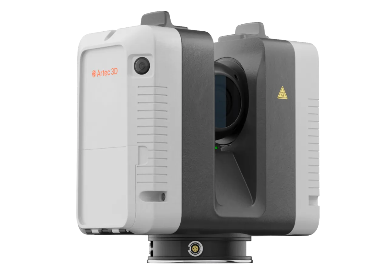
Artec Ray II
- Best for
- Pit, dump and stockpile faces — the volumes that carry the reconciliation
- Type
- Stationary long-range laser, tripod mounted
- Accuracy, up to
- 1.9 mm at 10 m, 2.9 mm at 20 m, 5.3 mm at 40 m
- Range noise
- 0.4 mm at 10 m
- Range
- 0.5–130 m
- Scan time
- 1 min 42 s at 3 mm, 10 m, without texture
- Field of view
- 360° × 300°
Ray II records a face from a tripod at 1.9 mm at 10 m and 5.3 mm at 40 m, out to 130 m, in under two minutes per station. Those are the surfaces whose volumes get reconciled against tonnes, and the accuracy is what makes the survey the figure the other two are checked against.
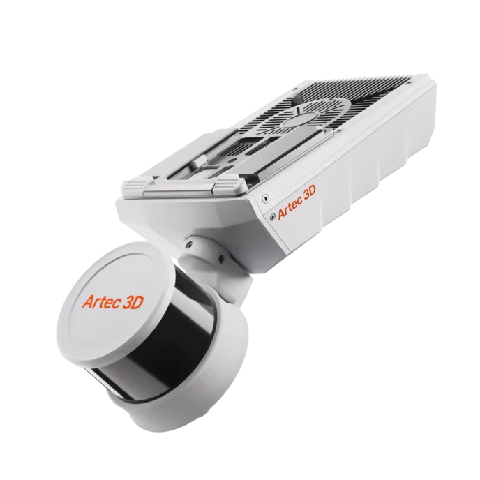
Artec Jet
- Best for
- Pit floors, roads, dump tops and large areas, from a vehicle
- Type
- Multi-modal SLAM LiDAR
- Accuracy, up to
- ±10 mm underground, ±15 mm general
- Change detection
- ±5 mm
- Range
- 0.5–300 m
- Positional drift
- ±0.03%
- Deployment
- Handheld, backpack, pole, drone, vehicle, cage, robot
Jet mounted on a vehicle records the areas between the faces at ±15 mm as it is driven, with no stations. It registers into the same Twins model, so the month-end surface is measured everywhere rather than interpolated between the places a tripod could reach.
See a month reconciled from two measured site models, with every volume traceable to the surface it came from — book a demo for your survey and mine planning teams.
Book a demoQuestions mine planning engineers ask
How much survey time does the month-end take with scanners?
Faces take under two minutes per tripod station and large areas are covered from a vehicle without stopping, so the month-end survey is measured in hours rather than days — and it is complete rather than sampled.
Can we separate ore and waste in the excavated volume?
Yes. The volumes are computed on mine grid, so the difference between the two models is split by the ore and waste polygons in the planning package, giving mined ore and mined waste separately.
How do we handle the reconciliation factor we carry today?
With a measured survey, the factor becomes something you can decompose: the difference between the scanned volume and the fleet tonnes is either density, payload or plant, not survey interpolation. That is what the complete surface gives you.
Does the model open in our planning package?
Twins exports LAS, LAZ, E57 and standard meshes. Maptek Vulcan, Deswik, Micromine and GEOVIA Surpac read them directly, and the reconciliation runs where it always has.
Related applications

Tell us how your month reconciles today
Describe the operation, the planning package and where survey, fleet and plant disagree. A mining specialist will come back with how a scanned month-end model would be built and what it would settle.