
Stockpile volume measurement
A stockpile volume is a number that gets invoiced, reported or reconciled, and it is produced by someone walking the pile with a GNSS pole and shooting a point every few metres — on ground that slumps, in front of loaders that are still working it.
From a tripod off the pile, a long-range scanner records the entire surface in under two minutes per station, at 1.9 mm at 10 m, and the volume is computed from millions of measured points rather than interpolated between a few dozen.
How accurate is a stockpile volume from a 3D laser scan?
The surface is recorded at 1.9 mm at 10 m from a tripod off the pile, so the volume comes from millions of measured points — and nobody walks the stockpile.
 The whole surfaceCrest, toe, every face and hollow, as measured points rather than interpolation.
 Off the pileFrom a tripod at a safe stand-off; loaders keep working.
 Under two minutes a stationA stockyard in a morning, on the same day the report is due.
 On mine gridGNSS georeferenced in Artec Twins, against the surveyed base or the pad.
Why a walked stockpile volume is an estimate
The GNSS method is limited by where a person can stand. The surveyor walks the crest and the toe and as much of the face as is safe, shooting a point every few metres. The surface between the points is interpolated, and the parts of the pile nobody could walk — a steep face, the side a loader is working, a slumped section — are interpolated across the widest gaps. On an irregular pile the interpolation is a real share of the volume, and it is the share nobody measured.
The number then has to stand up. A stockpile volume drives an invoice to a customer, a month-end inventory that reconciles against the weightometer, or a stock declaration that an auditor may question. When the survey and the weightometer disagree, the survey has no way to show which points were measured and which were assumed. And the surveyor has spent the morning on ground that slumps, in a yard with machines moving.
A long-range scanner records the surface, not a sample of it. Artec Ray II on a tripod off the pile captures everything in view at 1.9 mm at 10 m, 5.3 mm at 40 m, in under two minutes per station; two or three stations cover a large pile, and Artec Twins registers them into one surface on mine grid with GNSS. The volume is computed against the surveyed base from millions of measured points, and the report shows the surface it came from.
From tripod to reported volume
Nobody sets foot on the pile.
- 1. Set up off the pileRay II on a tripod at two or three positions around the stockpile, with line of sight to every face.
 2. Scan each stationA full 360° × 300° station in 1 min 42 s at 3 mm resolution and 10 m.
- 3. GeoreferenceTwins registers the stations and places them on mine grid with GNSS.
- 4. Compute the volumeThe scanned surface against the surveyed base or pad, with the surface it was computed from.
 5. ReportVolume, surface and point cloud as LAS, LAZ or E57 into the inventory and the planning package.
Which scanner for this work
A stockpile is measured from a distance for accuracy and for safety, which is the tripod scanner’s job; a yard too large for tripods is covered by the mobile one.
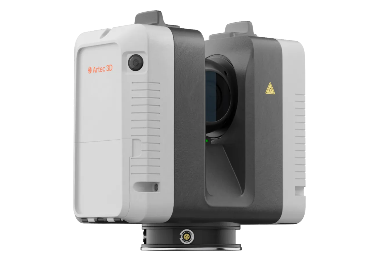
Artec Ray II
- Best for
- Stockpiles and stockyards — survey-grade volumes from a tripod off the pile
- Type
- Stationary long-range laser, tripod mounted
- Accuracy, up to
- 1.9 mm at 10 m, 2.9 mm at 20 m, 5.3 mm at 40 m
- Range noise
- 0.4 mm at 10 m
- Range
- 0.5–130 m
- Scan time
- 1 min 42 s at 3 mm, 10 m, without texture
- Field of view
- 360° × 300°
Ray II records a whole pile from a tripod at 1.9 mm at 10 m and 5.3 mm at 40 m, with a 360° × 300° view and a range of 130 m, in under two minutes per station. That is the accuracy an invoiced or audited volume needs, taken from ground the surveyor can safely stand on, while the loaders keep working.
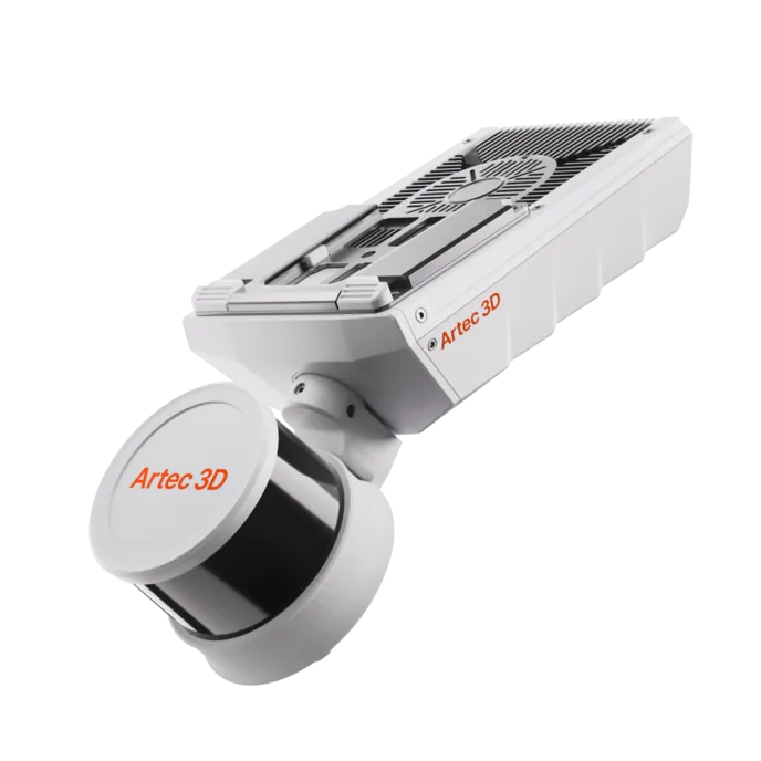
Artec Jet
- Best for
- A large stockyard or a run-of-mine pad, covered from a vehicle
- Type
- Multi-modal SLAM LiDAR
- Accuracy, up to
- ±10 mm underground, ±15 mm general
- Change detection
- ±5 mm
- Range
- 0.5–300 m
- Positional drift
- ±0.03%
- Deployment
- Handheld, backpack, pole, drone, vehicle, cage, robot
Where the area is the problem rather than the accuracy, Jet on a vehicle records the whole yard at ±15 mm as it is driven around, with no stations and no stopping. It registers into the same Twins model as the Ray II captures, so the high-value piles get the tripod and the rest gets covered.
See a stockyard measured from three tripod positions in a morning, with every volume computed from the full surface on mine grid — book a demo for your survey team.
Book a demoQuestions surveyors ask
How does the volume compare with our GNSS survey?
The scan measures the whole surface at 1.9 mm at 10 m; GNSS measures a point every few metres where someone could walk. Where the two differ, the difference is the interpolation — and the scan report shows the measured surface, which is what settles a dispute with the weightometer.
Do we need to stop the loaders?
No. The scanner works from a tripod off the pile and a station takes under two minutes. A loader in view is removed from the point cloud in processing; the stockpile is measured as it stands at that moment.
How is the base handled?
Against the surveyed pad or a base scan taken when the pile was down. Twins computes the volume between the two surfaces on mine grid; a base scan is taken once and reused.
Does the volume go straight into our inventory or planning package?
The surface and point cloud export as LAS, LAZ or E57, which Maptek Vulcan, Deswik, Micromine and GEOVIA Surpac read directly; the volume report goes with them.
Related applications

Tell us about the stockpiles you measure
Describe the yard, how often volumes are reported and what they are reconciled against. A mining specialist will come back with how many stations a survey would take and what accuracy the volume would carry.