
Underground void and cavity mapping
A void is a planning problem until it is a shape. A hang-up, an old stope on a level nobody uses, a cavity a drill hole broke into — until it is measured, every decision around it is made with a margin, and the margin is ore or safety.
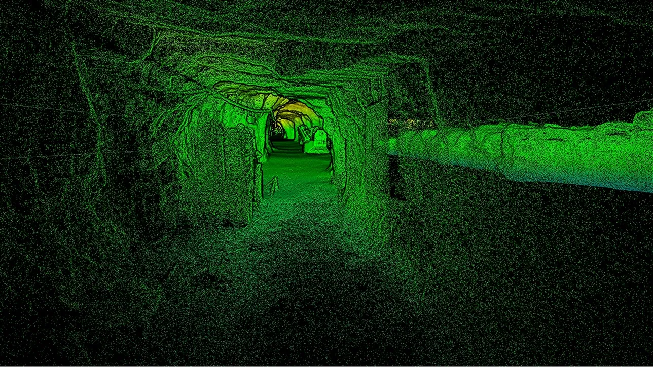
Flown or lowered into the cavity, the scanner records every wall and returns a solid that fits into the mine model where the gap used to be.
How do you map a void nobody can enter?
Lower or fly a SLAM LiDAR scanner into it: with no GPS and its own light, it records the full cavity at ±10 mm as a closed solid.
 Through a small openingA drill hole, a brow or a raise is enough to get the scanner in.
 The whole cavity360° × 290° of view from inside, so there is no far wall left to infer.
 No signal neededSLAM positioning and LiDAR light: nothing has to reach the scanner from outside.
 Into the mine modelThe solid replaces a hatched unknown in Vulcan, Deswik or Surpac.
Why a void stays a question mark
The methods for measuring a cavity from outside all share one limit: they see what is in a straight line from where they stand. A boom-mounted laser at the opening records the walls it can reach and misses the rest; a probe down a drill hole gives a profile along one axis. The void that ends up in the mine model is a best-fit around those readings, and the mine plans around a shape that is partly drawn.
Planning around an uncertain void costs ore and time. A pillar is left wider than it needs to be because the cavity behind it is not known; a development drive is redesigned to keep a stand-off from a shape that may not be where the model puts it; a backfill volume is ordered against an estimate and comes up short or over.
A scanner inside the void has no line-of-sight problem. Artec Jet is lowered through the opening on a pole or a cage, or flown in on a drone that plans its own path, and records the cavity from within — floor, walls and back at ±10 mm, in complete darkness. Artec Twins closes the capture as a solid, and the shape drops into the mine model where the question mark was.
From opening to modelled solid
The opening decides the deployment; everything after it is the same.
- 1. Find the way inA brow, a raise, a drill hole large enough for the scanner or a drone-sized opening — each has a deployment that fits.
 2. Capture from insideJet records at up to 1.9 million points per second with a 360° × 290° field of view, holding ±0.03% drift with no GPS.
 3. Register to the driveTwins ties the cavity capture to the surrounding development so the void sits in mine coordinates.
 4. Close and measureThe point cloud becomes a watertight solid with a volume, a maximum span and a distance to every neighbouring excavation.
 5. Update the modelLAS, LAZ or E57 and the solid into the planning package; the hatched unknown becomes a measured shape.
Which scanner for this work
Getting inside is the whole job, so the device is the one built to be sent in.
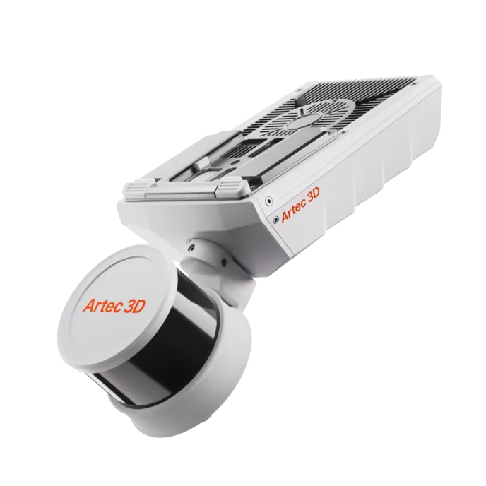
Artec Jet
- Best for
- Any cavity with an opening the scanner or a drone fits through
- Type
- Multi-modal SLAM LiDAR
- Accuracy, up to
- ±10 mm underground, ±15 mm general
- Change detection
- ±5 mm
- Range
- 0.5–300 m
- Positional drift
- ±0.03%
- Deployment
- Handheld, backpack, pole, drone, vehicle, cage, robot
Jet is 1.57 kg, IP65 and needs neither GPS nor light, which is what lets it be lowered on a pole, dropped in a cage or flown through an opening into a cavity. Inside it records everything in a 360° × 290° view at ±10 mm; back at the drive the capture registers to the development and closes as a solid with a volume.
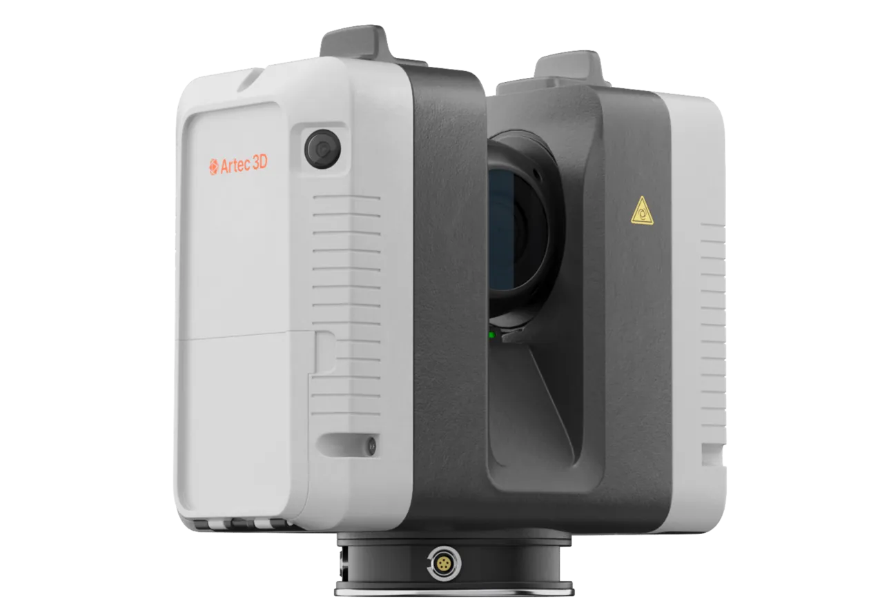
Artec Ray II
- Best for
- What is visible from the opening, at survey-grade, when nothing can be sent in
- Type
- Stationary long-range laser, tripod mounted
- Accuracy, up to
- 1.9 mm at 10 m, 2.9 mm at 20 m, 5.3 mm at 40 m
- Range noise
- 0.4 mm at 10 m
- Range
- 0.5–130 m
- Scan time
- 1 min 42 s at 3 mm, 10 m, without texture
- Field of view
- 360° × 300°
Where the void is open to view from a brow or a drive and nothing can be sent into it, Ray II records everything in line of sight at 1.9 mm at 10 m from a tripod at the opening. It also fixes the surrounding development at survey-grade, so the Jet capture from inside registers to a known frame.
See an unknown cavity turned into a measured solid in your mine model, with its volume and stand-offs — book a demo for your planning team.
Book a demoQuestions surveyors ask
How small an opening does the scanner need?
Jet is 1.57 kg and compact enough to lower on a pole or in a cage through a brow or a raise; a drone needs an opening it can fly through. A specialist will match the deployment to the openings you have.
Does it need light or a signal inside the void?
Neither. LiDAR provides its own light and SLAM provides position from the geometry, so nothing has to reach the scanner from outside. The cavity scans the same whether or not anything else works in there.
How accurate is the volume?
The surface is recorded at ±10 mm underground, and the solid is closed from that surface rather than fitted around a few readings. The volume error is dominated by how much of the cavity is captured — which, from inside, is all of it.
Can we scan the same void again later?
Yes, and comparing the two captures is where the ±5 mm change detection applies: a cavity that is growing shows as a coloured difference surface between the epochs.
Related applications

Tell us about the void you need to map
Describe the cavity, how it was found and what access exists to it. A mining specialist will come back with a deployment that fits the opening and what the capture would give your model.